This story has been archived and will no longer be updated. For the most up-to-date information, click here.
The Gulf of Mexico is loading up with tropical moisture for what looks to be another potential tropical threat — perhaps a named system — for Florida by midweek.
But days ahead of the storm, rounds of tropical downpours will stream our way along a stalled front, funneling moisture out of the Gulf into Florida.
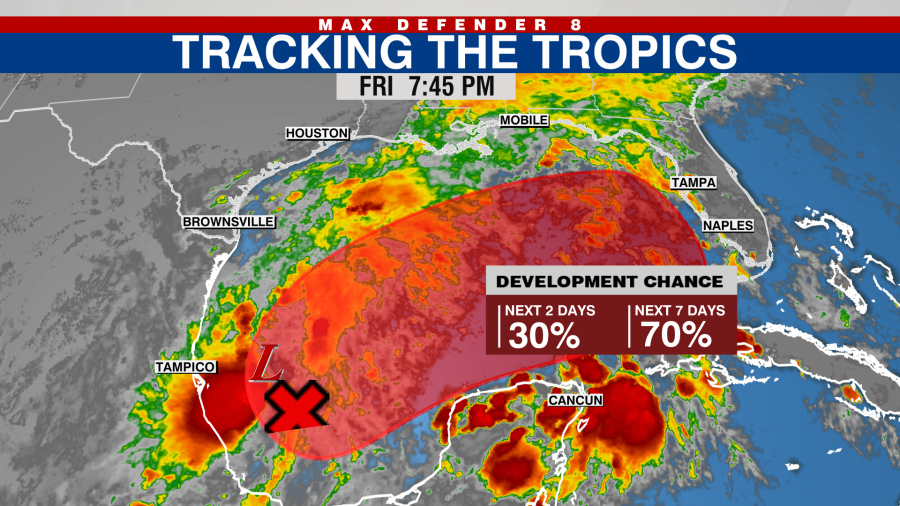
The models coming into better agreement on Friday that a named system will form in the Gulf by early next week. Right now the National Hurricane Center has a 70% chance of development, but that has increased from 30% just 24 hours prior.
After a nice Saturday, heavy downpours will begin Sunday afternoon as the first wave of moisture reaches us. This kind of pattern — rounds of downpours and dry breaks — will continue through Tuesday.
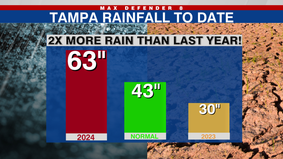
Obviously, given that the ground is saturated after one of the rainiest wet seasons on record, any downpours will lead to flooding.
Then we turn our attention the the central Gulf. By Monday we may have a named system forming and heading northeast across the Gulf at a decent clip. The latest models show the system moving into Florida by Wednesday, give or take a day.
While the most likely outcome is a tropical storm, there are some hints that any system that forms may have enough time to become a low-end hurricane. It’s just too early to make that call.
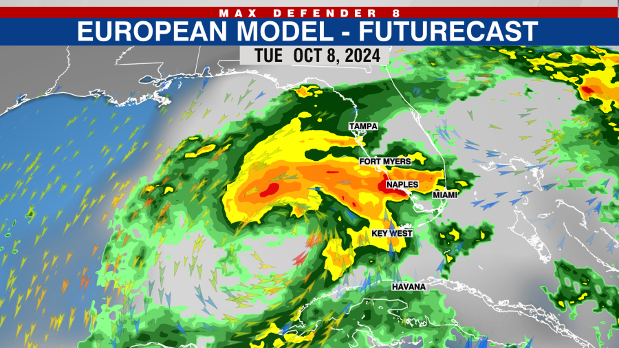
Regardng track, it’s way too early to be sure. The consensus of models show a track anywhere from Tampa Bay southward to Southwest Florida. Without knowing the exact track of the system, details like how high/where the highest surge will be, and who gets the strongest gusts, are impossible to determine. In fact, it is not even clear a defined tropical system will form.
It is worth saying that this will not be a storm like Hurricane Helene. Still, the area is fragile and any storm is not welcome.
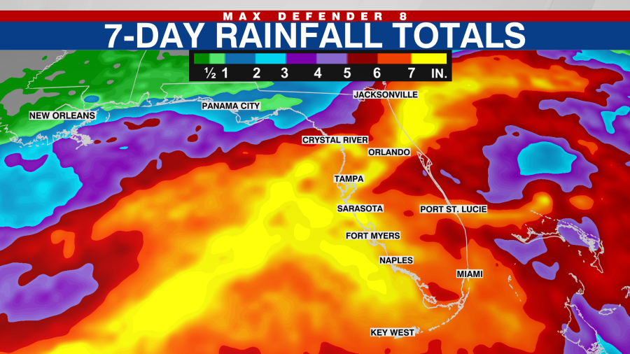
One thing that seems clear is that there will be heavy rain across the state starting Sunday and ending mid to late week. All told, a widespread 5-10″ is possible from Central to South Florida with some areas picking up more than a foot.
So prepare for unsettled weather and perhaps more than that. We should have much more information by Sunday-Monday.


