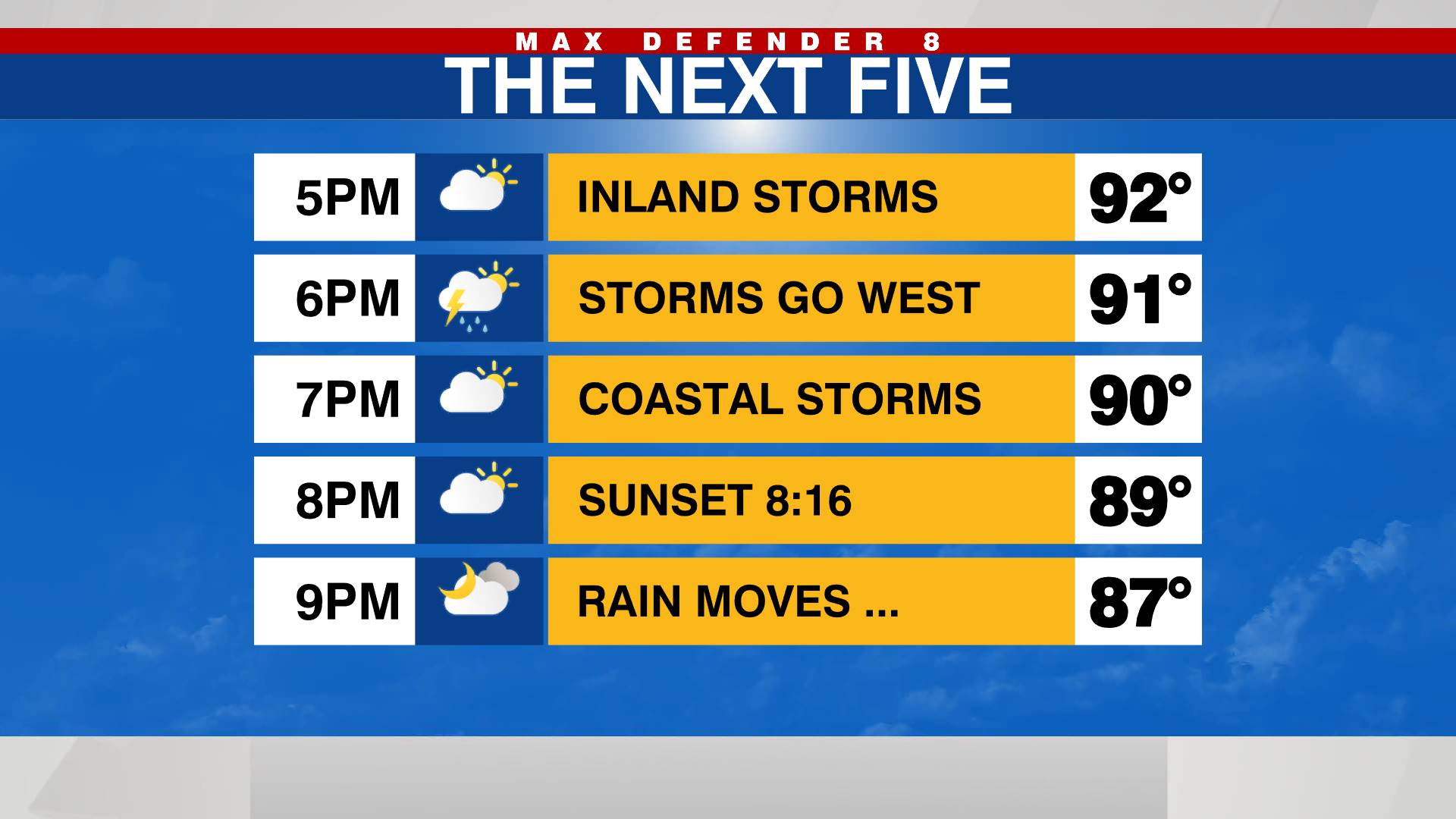
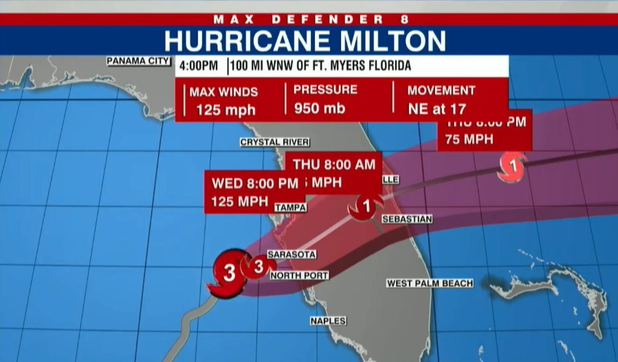
TAMPA, Fla. (WFLA) — Hurricane Milton continues to push closer to our coastline, and the impacts begin well before landfall. The storm was downgraded to a Category 3 hurricane Wednesday afternoon as its projected landfall timing was also moved up substantially.
Rounds of downpours hit the Tampa Bay area as the rain bands passed through Wednesday afternoon. Tropical storm-force winds reached the coast and tornado warnings were issued in multiple counties. At least one tornado touched down, crossing I-75 in South Florida.
THIS EVENING
Power outages were already reported across the Tampa area and expected to spread as damaging winds arrive in the evening hours. About 70,000 customers were without power in south central Florida as of 4:30 p.m.
As the strongest winds make it to the coast, the winds will howl and downpours will continue. Coastal Pinellas, Manatee and Sarasota counties will begin to feel the eye wall. Wind gusts up to 110 mph are in the forecast, which could cause serious damage to homes, power infrastructure and trees.
TONIGHT
Hurricane Milton’s landfall was moved up substantially. It was originally forecast for the overnight hours, but it is now expected to be around 7 p.m. or 8 p.m.
It’s projected to hit the coast as a Category 3 hurricane.
The exact path of the storm continued to wobble, jogging north again around 4 p.m.

Where exactly the storm hits will impact where the worst of the storm surge occurs.
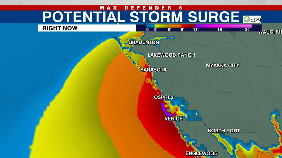
Storm surge of 10-15 feet is expected in the areas about 50 miles south of the eye at landfall. This is higher than a single-story home.
A storm surge warning was in effect for the west coast of Florida, from Flamingo northward to the Suwannee River, including Charlotte Harbor and Tampa Bay.
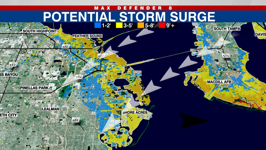
Communities along the shores of Tampa Bay may see the bay waters pushed out of its banks. The threat of multi-story storm surge in Pinellas and Hillsborough counties was growing less concerning Wednesday evening as the storm pivoted toward Sarasota and Manatee counties, though several feet were still possible.
Closer to Sarasota, the storm surge could be as high as 10 to 15 feet.
OVERNIGHT AND THURSDAY MORNING
As Milton tracks inland, hurricane-force winds reach east of I-75 and into Polk County overnight. There will be a path just north of the eye that receives 12-18 inches of rainfall. This rainfall accumulation will likely lead to flooding into homes.
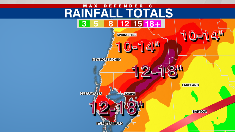
Hurricane-force winds will then push east through Polk County and reach Florida’s east coast. It dries out quickly behind the center of circulation, so rainfall will quickly end in the morning.
THURSDAY AFTERNOON
Less humid air arrives, but a few quick, light showers are possible.
Watch Tracking the Tropics on Tuesdays at 12:30 p.m. ET/11:30 a.m. CT.
Be prepared with the 2024 Hurricane Guide and stay ahead of tropical development with the Tracking the Tropics newsletter.


