TAMPA, Fla. (WFLA) —After the Tampa Bay area’s most oppressive summer on record, and back-to-back major hurricanes, the area deserves a change.
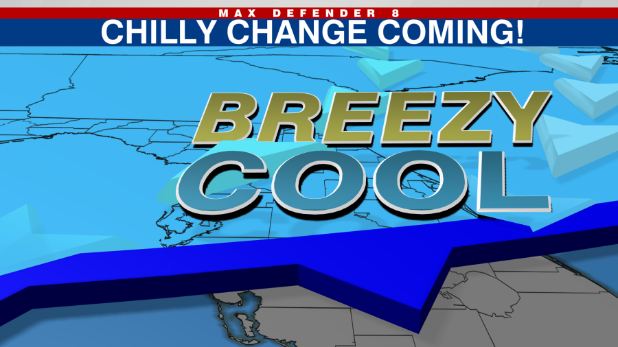
A strong cold front will arrive Wednesday with gusty north winds and the coldest air in seven months. Believe it or not, sweaters and jackets will be a good idea as temperatures plummet into the 50s.
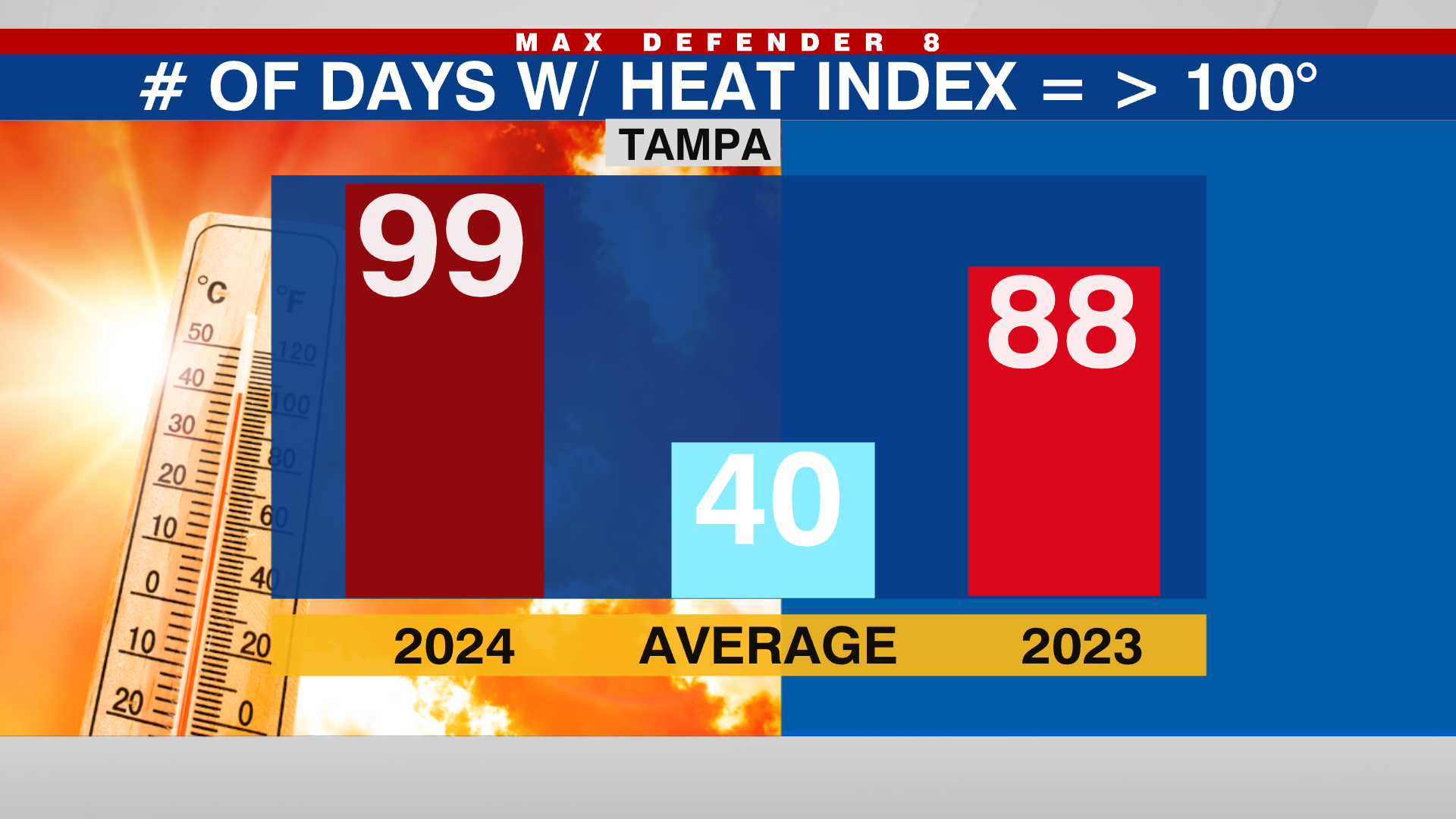
Now before we discuss the chilly change, let’s wrap up the hot season with a few quick stats. It was the most oppressive and wettest rainy season on record. Tampa and St. Petersburg both experienced record days with a heat index of 100 or higher. And so far Tampa and Sarasota have had their wettest years on record.

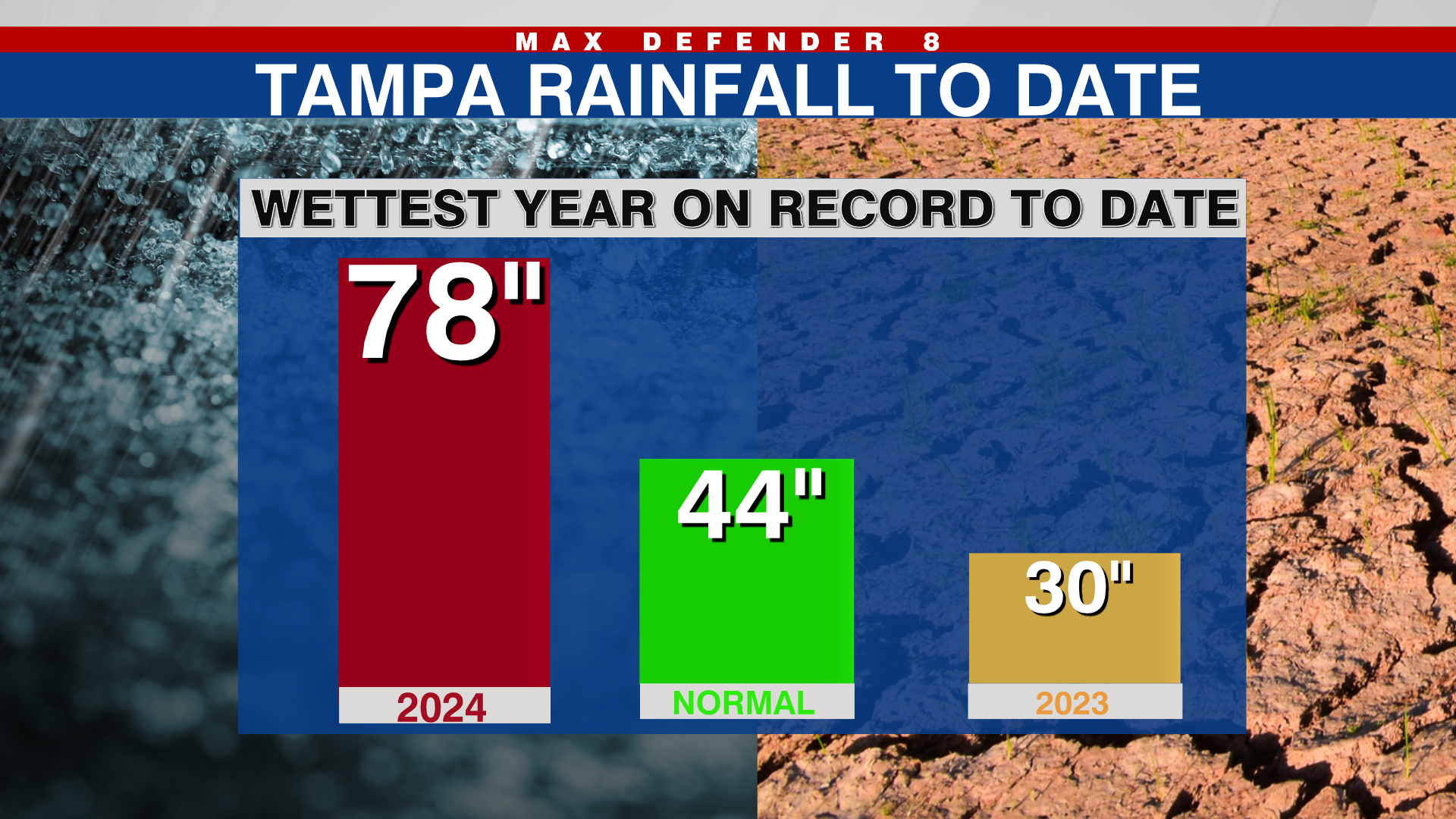
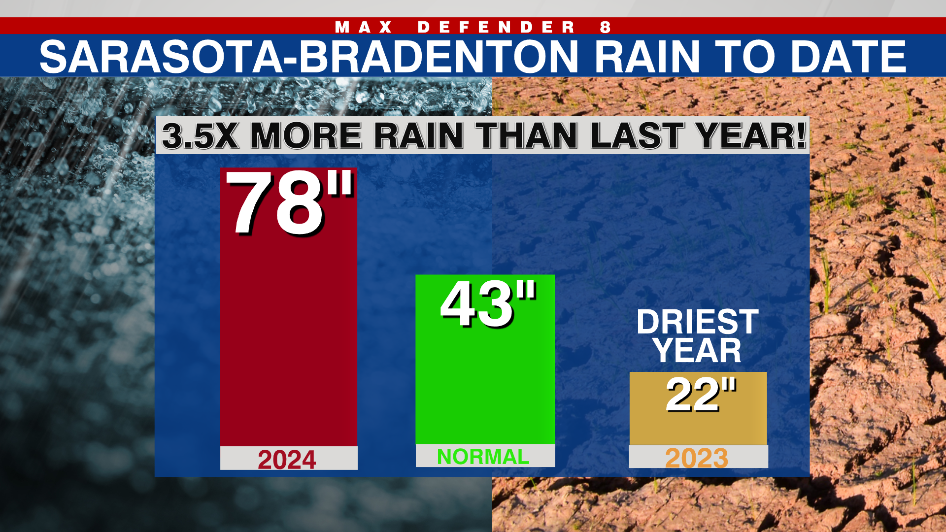
But the rainy season has officially come to an end with 66″ of rain in Tampa between June and October — more than double the average of 32.5″. And with the end of the wet season, we also see the end to the stifling heat and humidity.
On Wednesday, a strong cold front will move through early in the morning. As a result, the Tampa Bay area will see early high temperatures in the 70s followed by falling temperatures starting around lunchtime. We will spend most of the day in the 60s with gusty north winds from 15 to 25 mph.
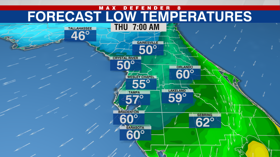
Temperatures will fall fast Wednesday night so that by Thursday morning, lows will bottom out in the 50s for most of the Tampa Bay area. Our thinned blood from summer warmth will likely require sweaters and jackets first thing Thursday morning.
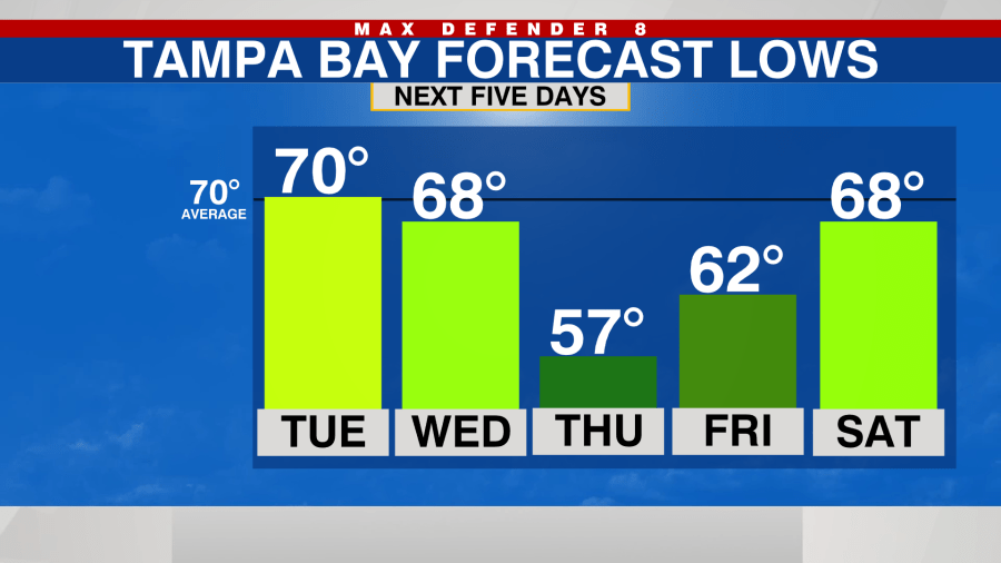
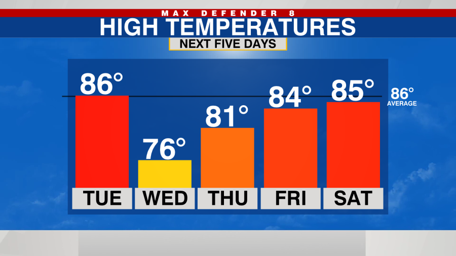
It will stay cool for a couple of days but temperatures will rebound back to normal by the weekend. However, winds will stay quite gusty through Sunday.


