TAMPA, Fla. (WFLA) — Flash Flood Warnings have been issued for Pinellas, Polk, Hernando, Hillsborough, and Pasco counties until 1:00 a.m.
Forecast
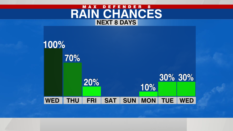
Rounds of rain are expected through the day today as Hurricane Milton’s rain bands arrive. The wind gradually picks up by the afternoon as the storm gets closer to the shore.
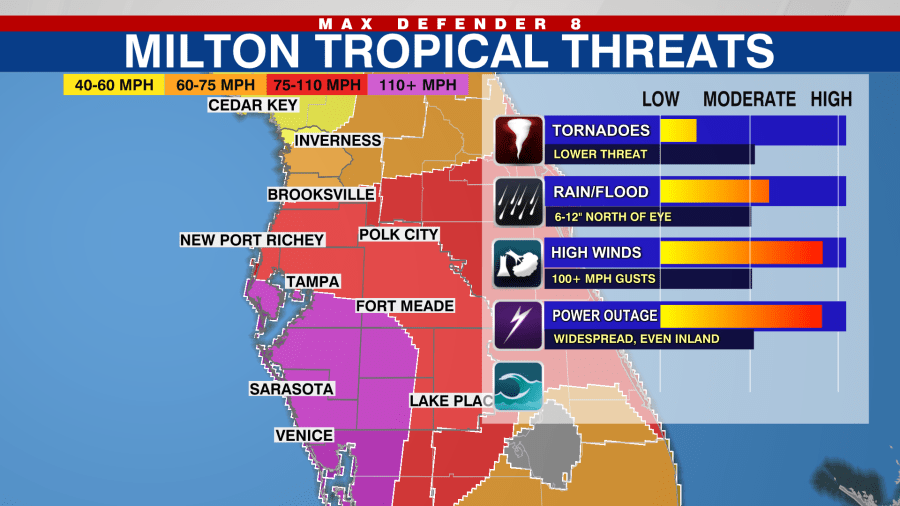
Conditions deteriorate this evening. Milton should make landfall as a major hurricane, and the Tampa Bay area hasn’t seen a major hurricane since 1921. This will do significant damage to many structures where it passes.

The highest storm surge will push onshore south of where the eye makes landfall. The water in that area could reach 10-15 feet, completely covering some single story homes.

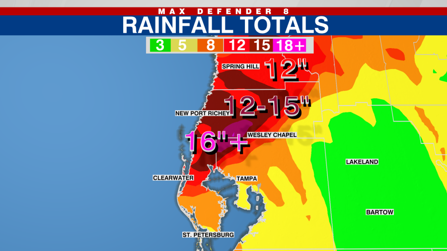
On the northern side of the storm is where the highest rainfall totals accumulate. Most areas will get 6-10 inches, but there will be spots that get more than a foot of rain. This will create flooding, and water may creep into homes.

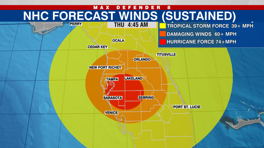
The storm brings hurricane-force winds inland as it tracks toward the east coast. Power outages will be widespread and may last for days.

Once Milton makes it into the Atlantic, slightly cooler and less humid air arrives on the backside. Temperatures drop into the 60s Thursday and Friday nights, so it’ll make living without air conditioning a little more tolerable.

We may see a few quick, light showers around Friday, but it stays mostly dry through the weekend.


