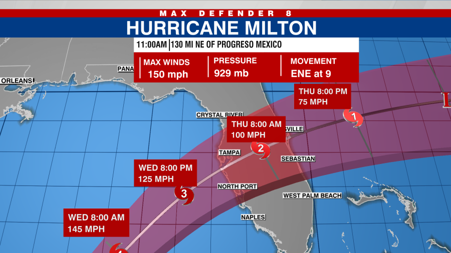
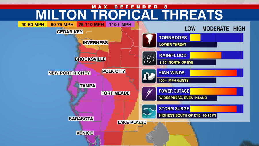
TAMPA, Fla. (WFLA) – Today is the last day to get preparations done before it’ll be time to ride out the storm tomorrow.
There will be passing showers especially this afternoon across Tampa Bay. It’ll be breezy and warm with highs in the mid 80s.
Tropical storm force winds arrive south of I-4 Wednesday morning. Rounds of rain expected as the bands wrap around Milton.

The wind increases steadily through the day tomorrow as a major hurricane approaches the west coast of Florida. Landfall is expected late Wednesday night, and it’ll push inland through the pre-dawn hours of Thursday.

Where the system makes landfall will determine which areas are hardest hit. A landfall in Pinellas county brings the highest surge in Pinellas, Tampa Bay, and Manatee counties. Surge could reach 10-15 feet in many spots. A landfall slightly farther south would limit the surge in Tampa Bay, but increase the height of the water for Manatee and Sarasota counties.

Widespread power outages are likely, and they will last for days.
Behind the storm, less humid air arrives for the end of the week.


