Jeff Berardelli is WFLA’s Chief Meteorologist and Climate Specialist
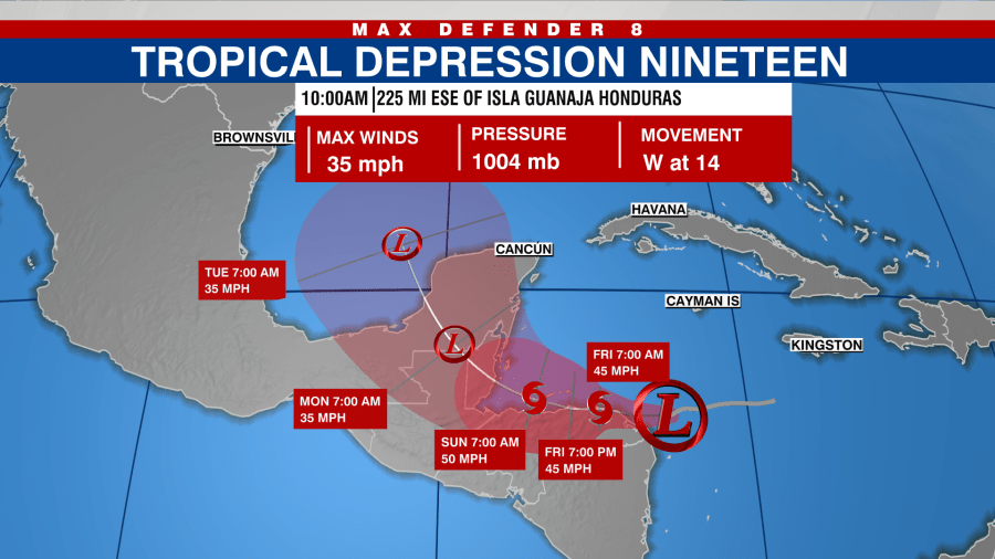
Tropical Storm Sara finally formed Thursday morning, and its future is becoming more clear. While it seems Sara is destined for the Gulf of Mexico next week, it looks like a weak storm at best by that time.
Sara is located near the coast of Honduras. It will meander for the next three days close to the coast, if not slightly inland. Due to the land interaction, Sara will have a hard time intensifying. But due to the very mountainous terrain, life-threatening flash flooding is likely as Sara stalls and batters the region.
A widespread 10-20 inches of rain will fall, with isolated-elevated locations receiving over 30 inches. This will bring catastrophic flooding to the area.

While Sara’s extended stay over Honduras will be destructive for that nation, it also will keep Sara from becoming a major hurricane. If Sara was just 100 miles further north we’d be dealing with a major hurricane due to record hot ocean heat content in the area.
Once Sara departs Honduras, it will move northwest, and once again strike land over the Yucatan. This will further weaken the storm, and Sara is likely to emerge over the Southern Gulf as either a depression or even a remnant low.
This is a far cry from what the models pictured just two days ago depicting a major hurricane sliding north from the Caribbean into the Gulf, uninteruppted by land, and bringing a hurricane landfall to Florida. This no longer seems likely.
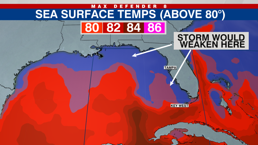
Instead, once Sara reaches the Gulf by Monday, it likely won’t have a good enough structure to regenerate into a powerful system. That is due not only to the weakened core but also water temperatures in the northern half of the Gulf that are below the critical 80-degree threshold.
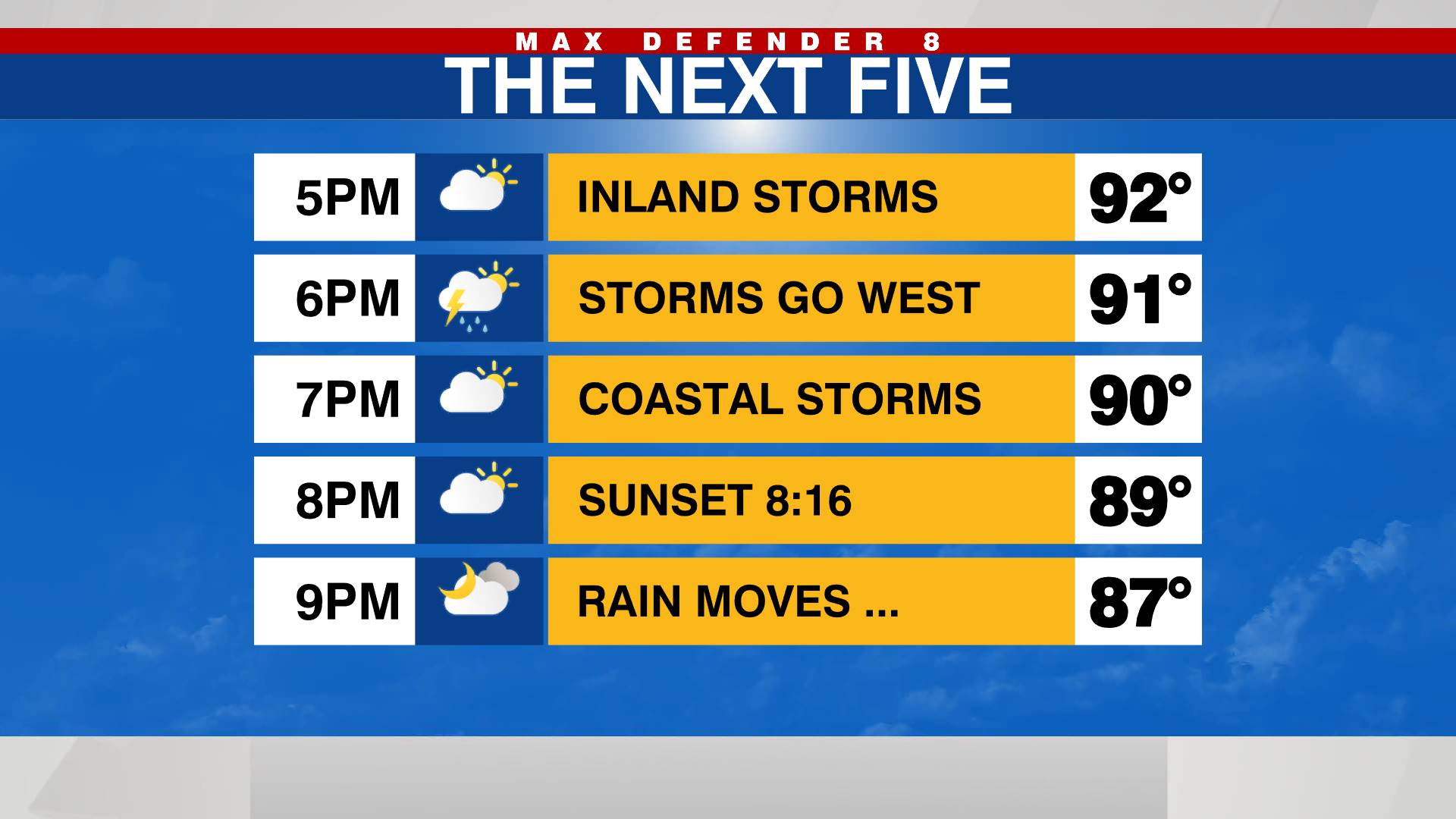
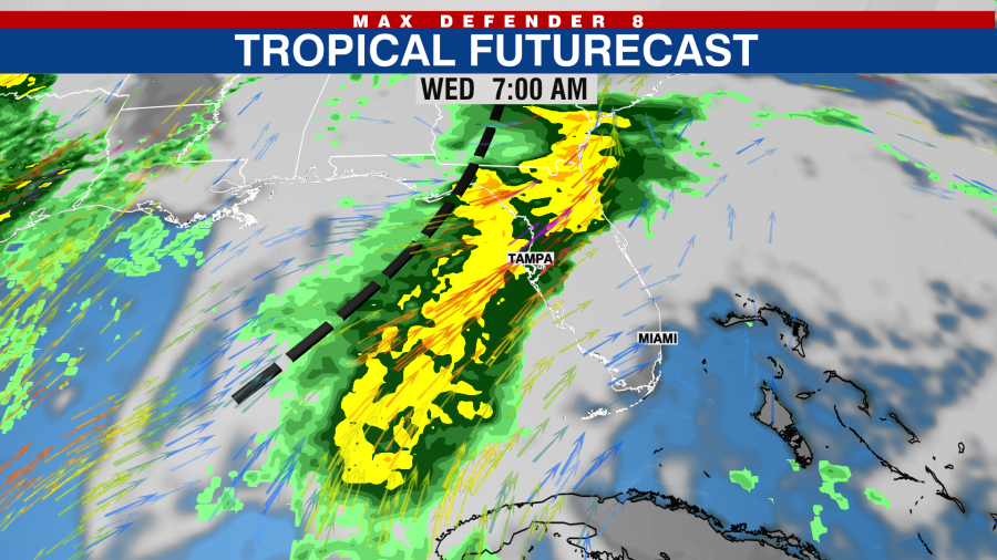
So the most likely scenario now is for the left over moisture, or a weak depression, to be pulled northeastward by a front in the northern Gulf. The impact on the Bay Area will be some heavy downpours, gusty winds and isolated tornadoes on Wednesday, but probably not much more.
This still could change but for now it seems the worst case scenario is no longer viable.