PHOTOS: First look at Siesta Key after Hurricane Milton
Elizabeth Klynstra and Sara Filips
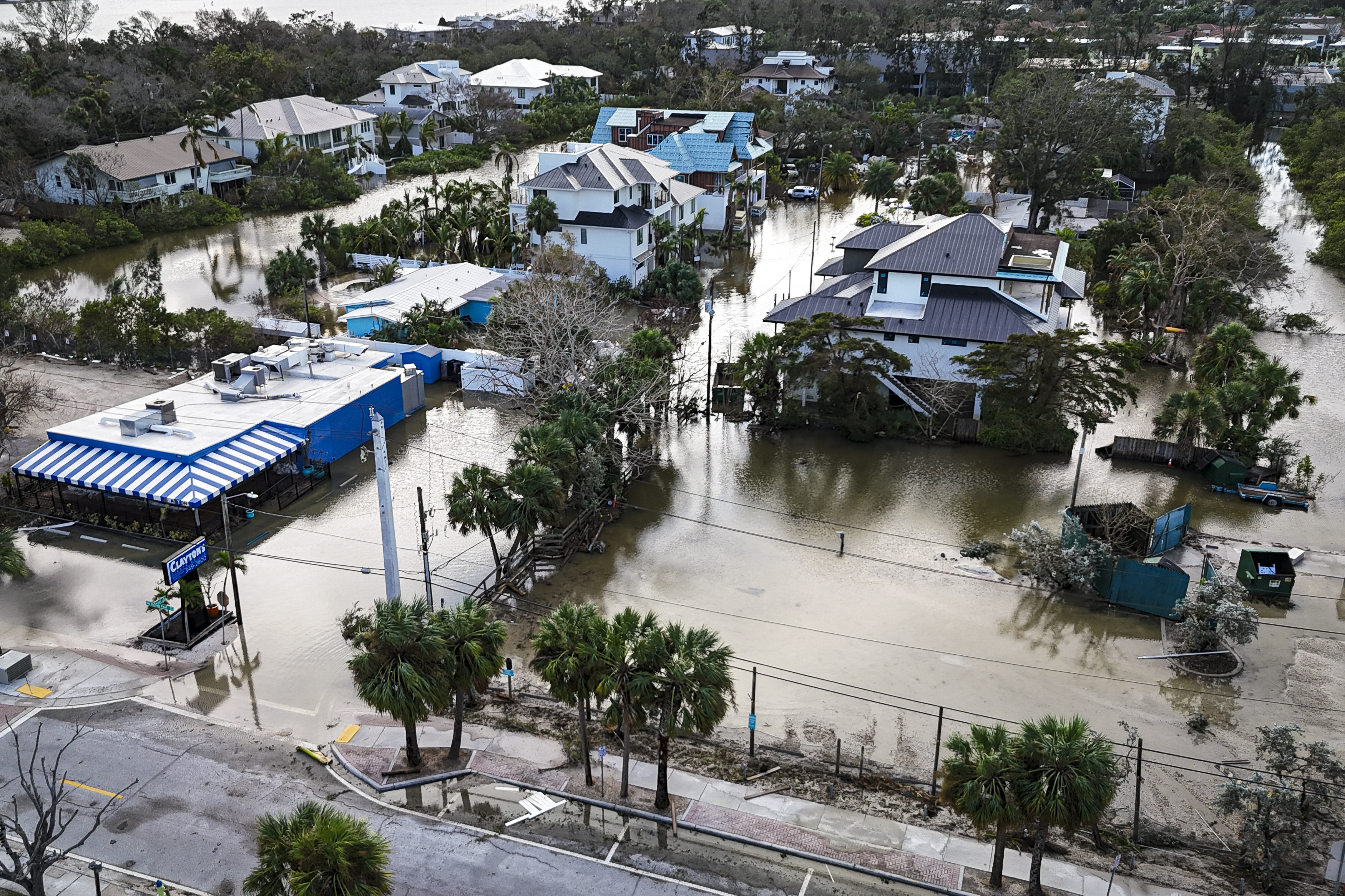
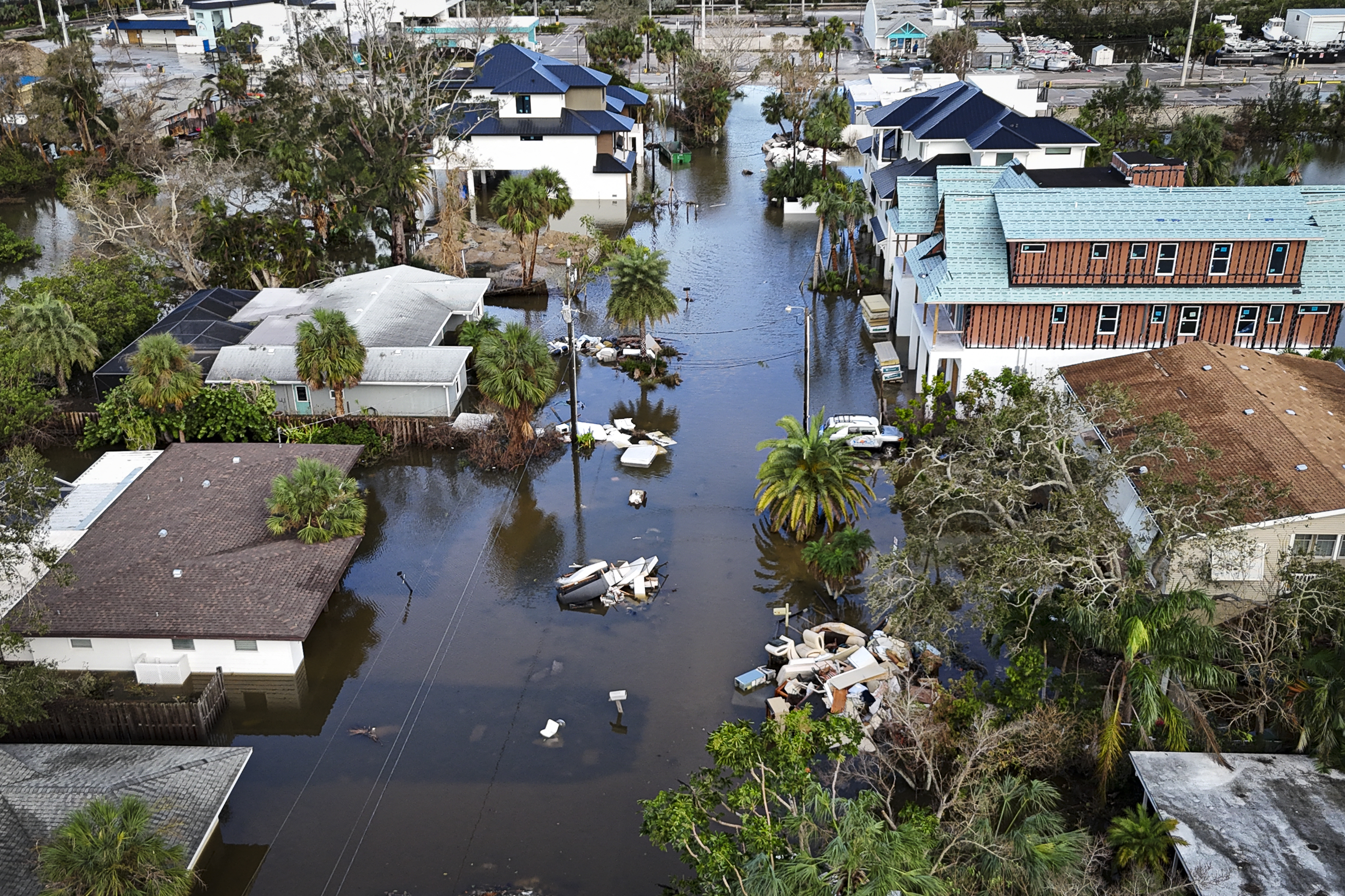
A drone image shows a flooded street due to Hurricane Milton in Siesta Key, Florida, on October 10, 2024. At least four people were confirmed killed as a result of two tornadoes triggered by Hurricane Milton on the east coast of the US state of Florida, local authorities said Thursday. (Photo by Miguel J. Rodriguez Carrillo / AFP) (Photo by MIGUEL J. RODRIGUEZ CARRILLO/AFP via Getty Images)
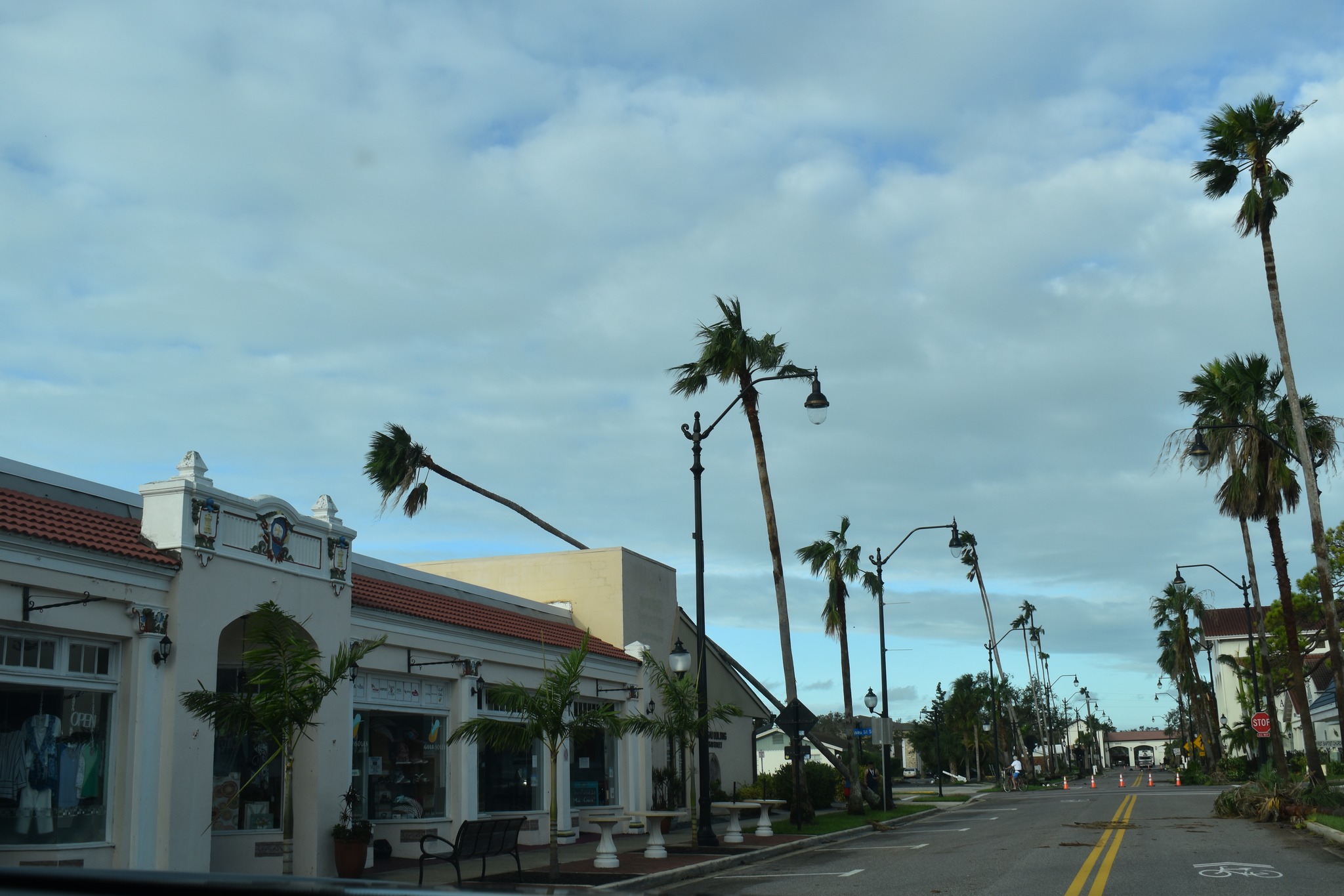
SIESTA KEY, Fla. (WFLA) — Hurricane Milton made landfall as a Category 3 hurricane near Siesta Key on Oct. 9.
The eye of the storm reached land around 8:30 p.m. with maximum sustained winds of 120 mph.
Aerial images show the damage in Siesta Key, and in Osprey, which is located just inland of the island.
Do you know of something newsworthy happening in your community? Report It! Send in tips, photos videos and other information here.
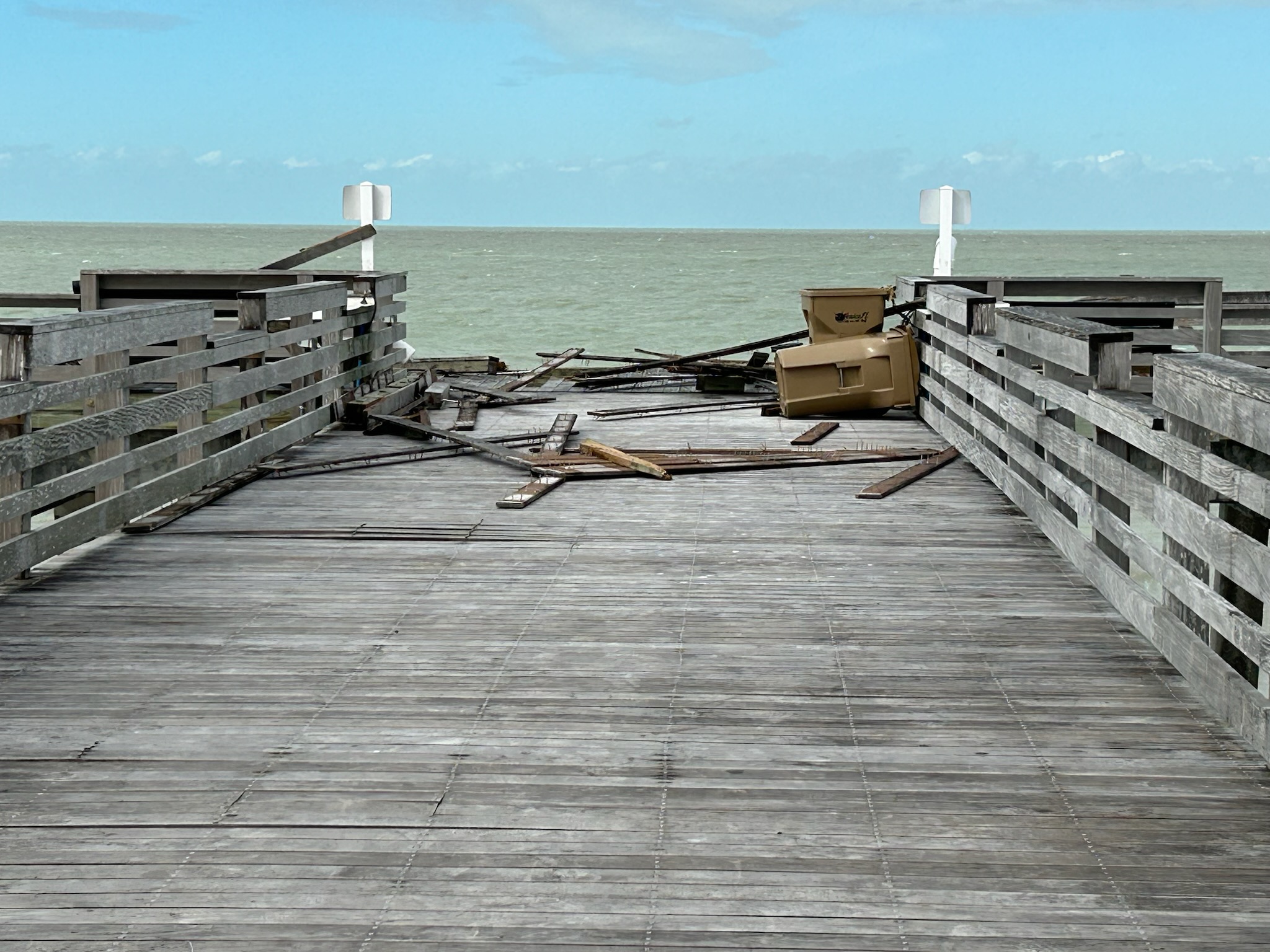
SIESTA KEY
A drone image shows a flooded street due to Hurricane Milton in Siesta Key, Florida, on October 10, 2024. At least four people were confirmed killed as a result of two tornadoes triggered by Hurricane Milton on the east coast of the US state of Florida, local authorities said Thursday. (Photo by Miguel J. Rodriguez Carrillo / AFP) (Photo by MIGUEL J. RODRIGUEZ CARRILLO/AFP via Getty Images)
A drone image shows a flooded street due to Hurricane Milton in Siesta Key, Florida, on October 10, 2024. At least four people were confirmed killed as a result of two tornadoes triggered by Hurricane Milton on the east coast of the US state of Florida, local authorities said Thursday. (Photo by Miguel J. Rodriguez Carrillo / AFP) (Photo by MIGUEL J. RODRIGUEZ CARRILLO/AFP via Getty Images)
A drone image shows a flooded street due to Hurricane Milton in Siesta Key, Florida, on October 10, 2024. At least four people were confirmed killed as a result of two tornadoes triggered by Hurricane Milton on the east coast of the US state of Florida, local authorities said Thursday. (Photo by Miguel J. Rodriguez Carrillo / AFP) (Photo by MIGUEL J. RODRIGUEZ CARRILLO/AFP via Getty Images)
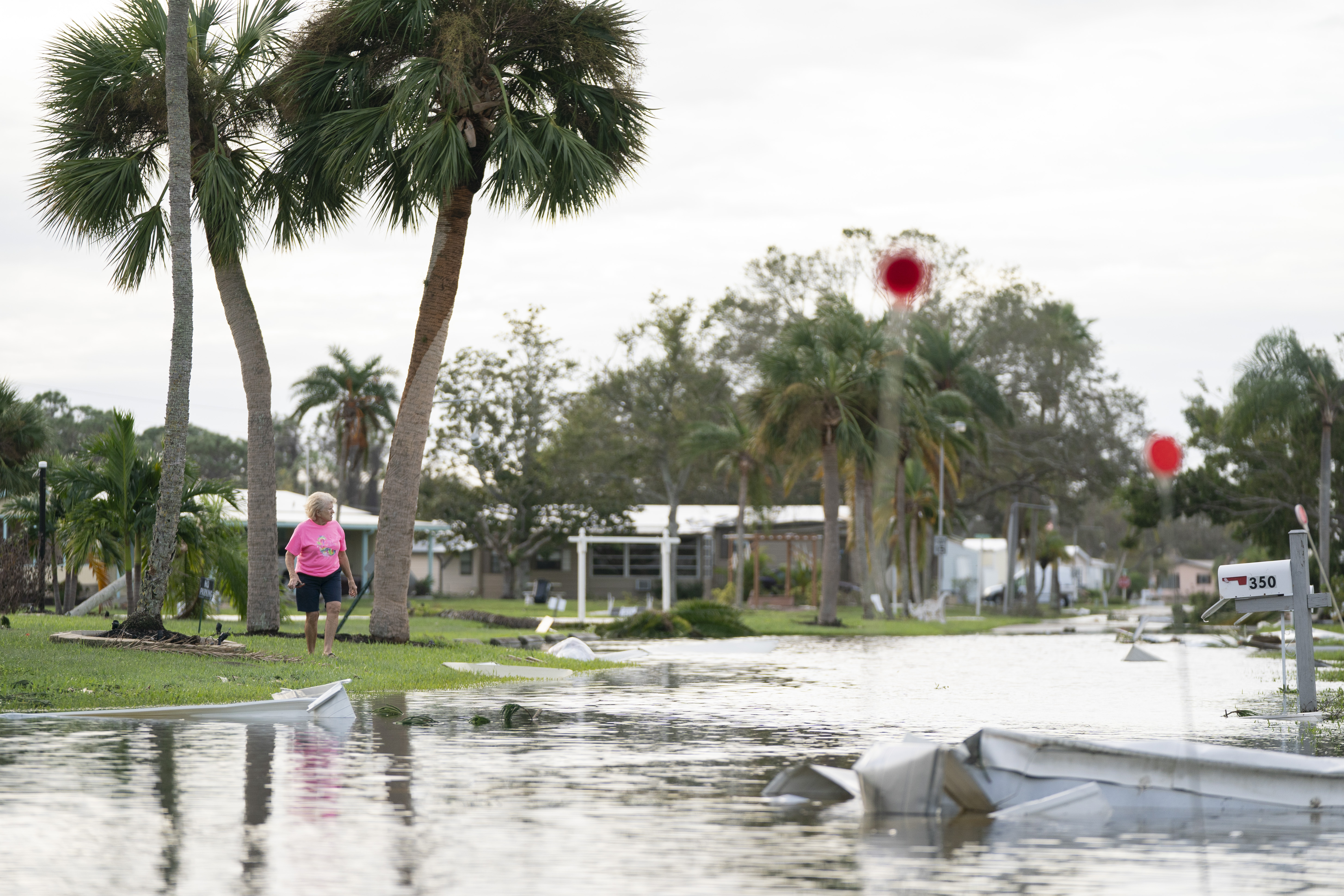
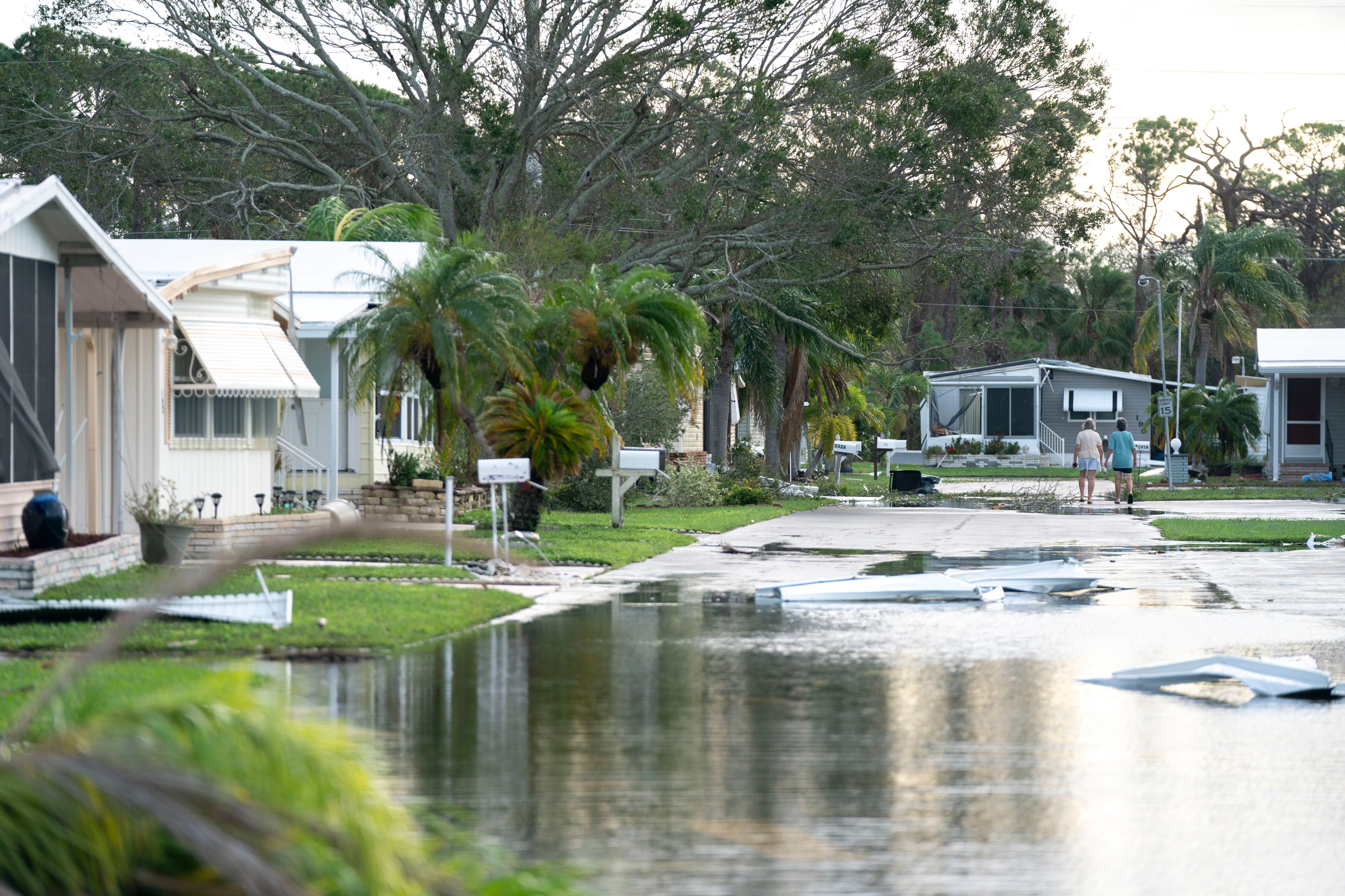
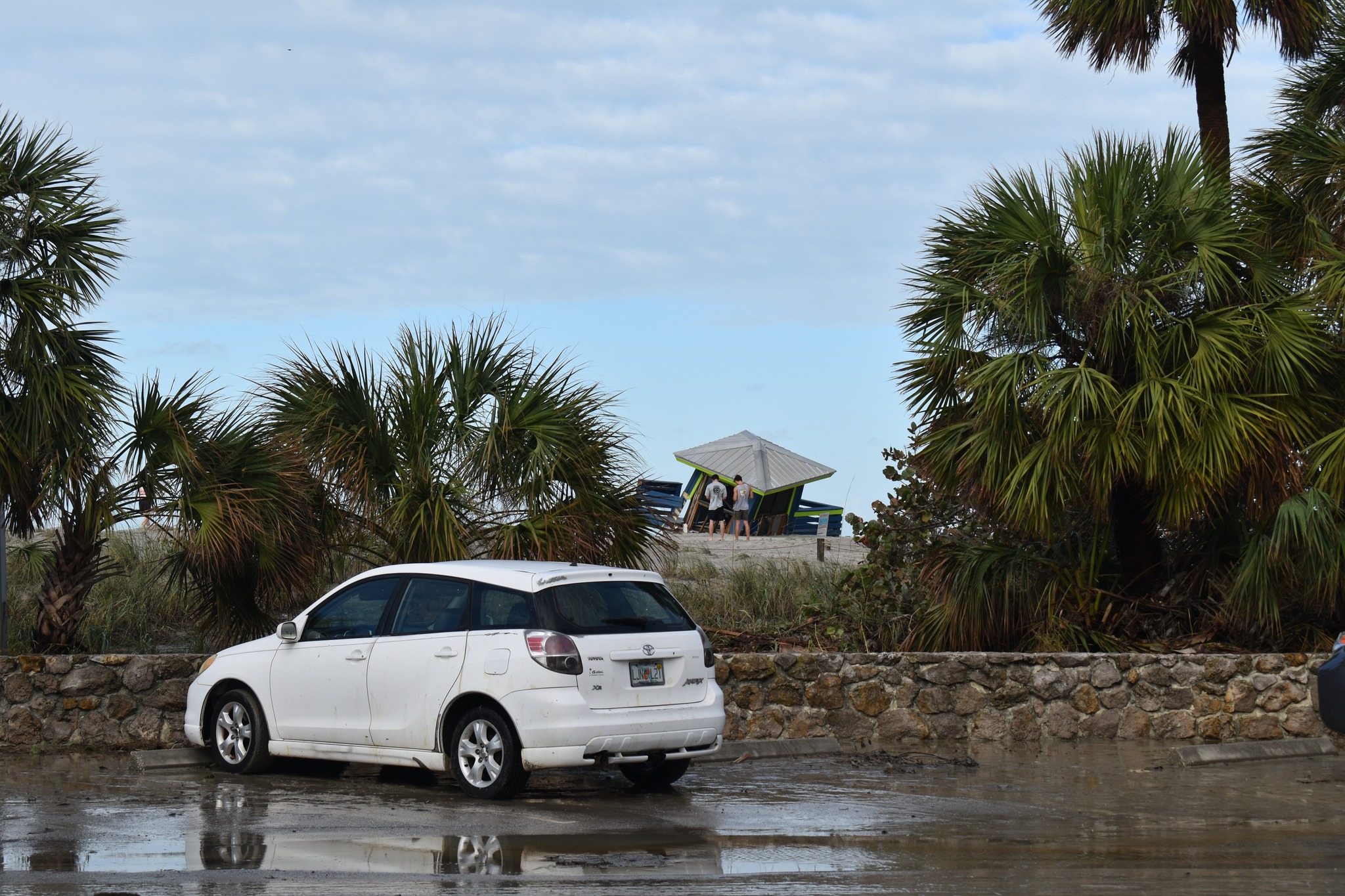
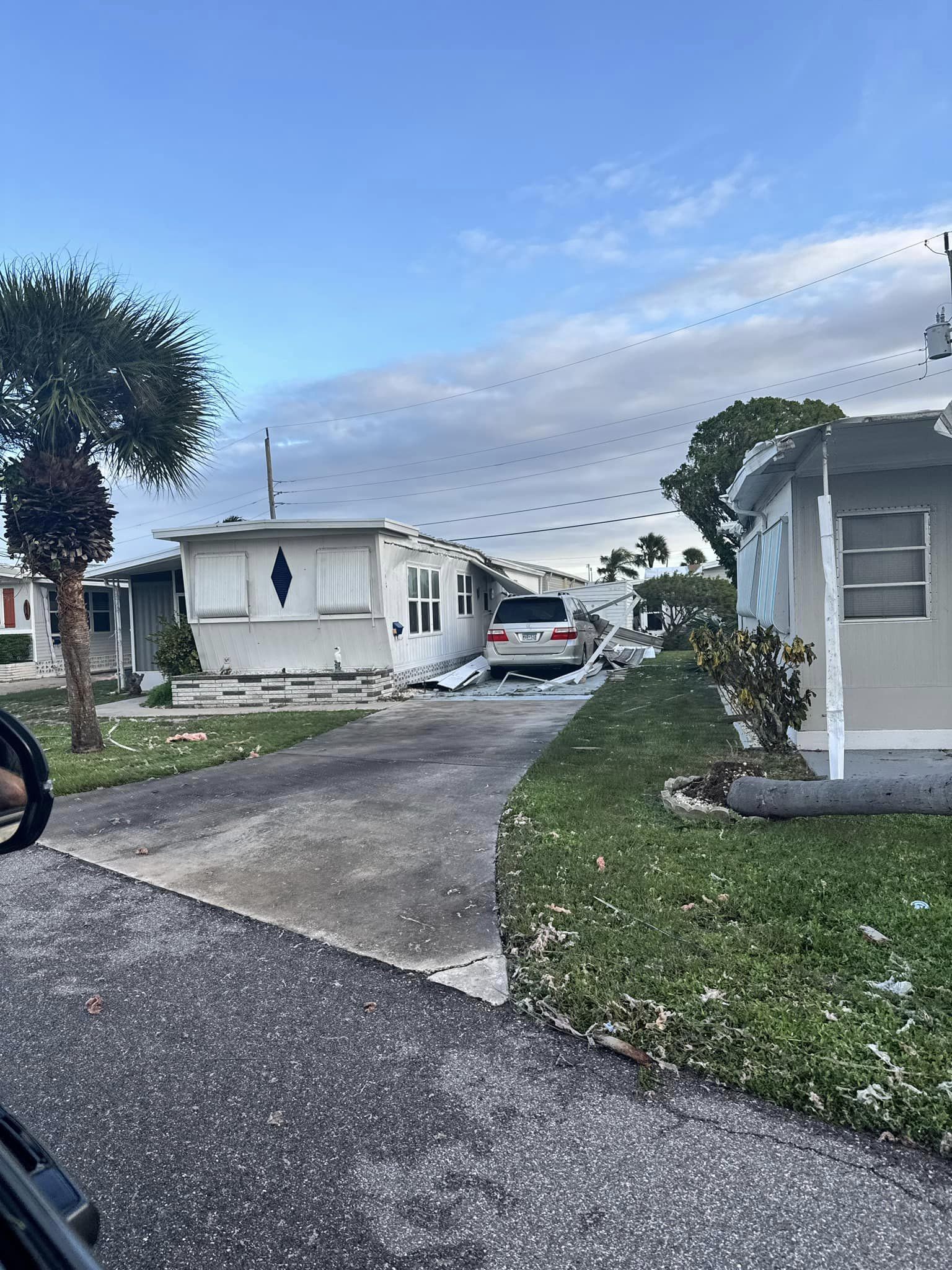
OSPREY
OSPREY, FLORIDA – OCTOBER 10: A woman walks near a flooded street in the aftermath of Hurricane Milton on October 10, 2024 in Osprey, Florida. The hurricane made landfall as a Category 3 hurricane in the Siesta Key area. (Photo by Sean Rayford/Getty Images)
OSPREY, FLORIDA – OCTOBER 10: Storm damage in the aftermath of Hurricane Milton on October 10, 2024 in Osprey, Florida. The hurricane made landfall as a Category 3 hurricane in the Siesta Key area. (Photo by Sean Rayford/Getty Images)
OSPREY, FLORIDA – OCTOBER 10: People walk near a flooded street in the aftermath of Hurricane Milton on October 10, 2024 in Osprey, Florida. The hurricane made landfall as a Category 3 hurricane in the Siesta Key area. (Photo by Sean Rayford/Getty Images)
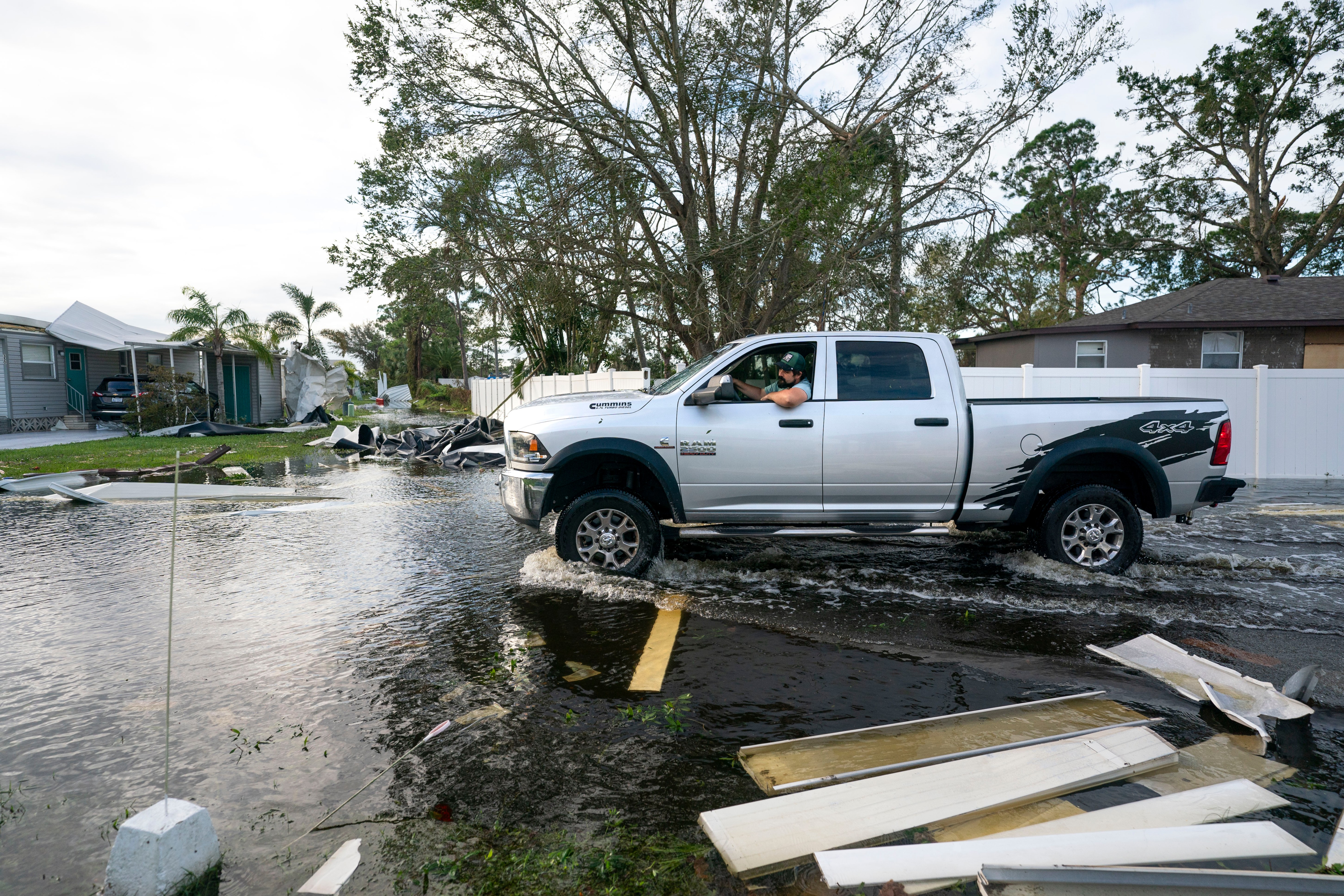
OSPREY, FLORIDA – OCTOBER 10: A motorist drives through a flooded street in the aftermath of Hurricane Milton on October 10, 2024 in Osprey, Florida. The hurricane made landfall as a Category 3 hurricane in the Siesta Key area. (Photo by Sean Rayford/Getty Images)
OSPREY, FLORIDA – OCTOBER 10: Storm damage in the aftermath of Hurricane Milton on October 10, 2024 in Osprey, Florida. The hurricane made landfall as a Category 3 hurricane in the Siesta Key area. (Photo by Sean Rayford/Getty Images)
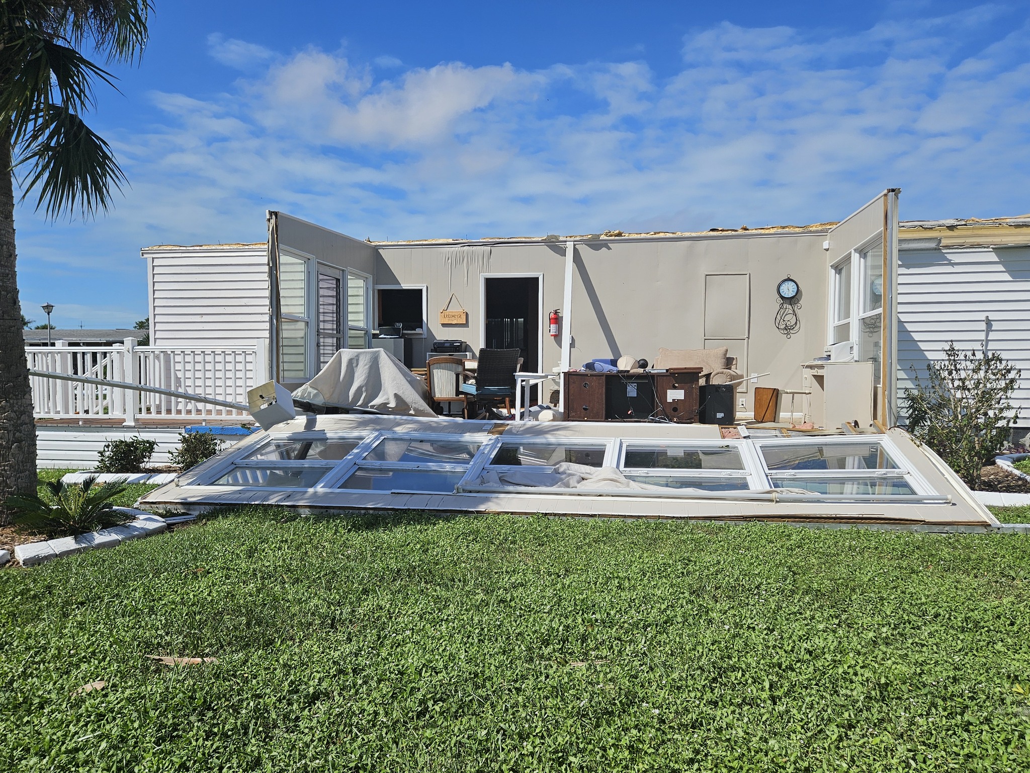
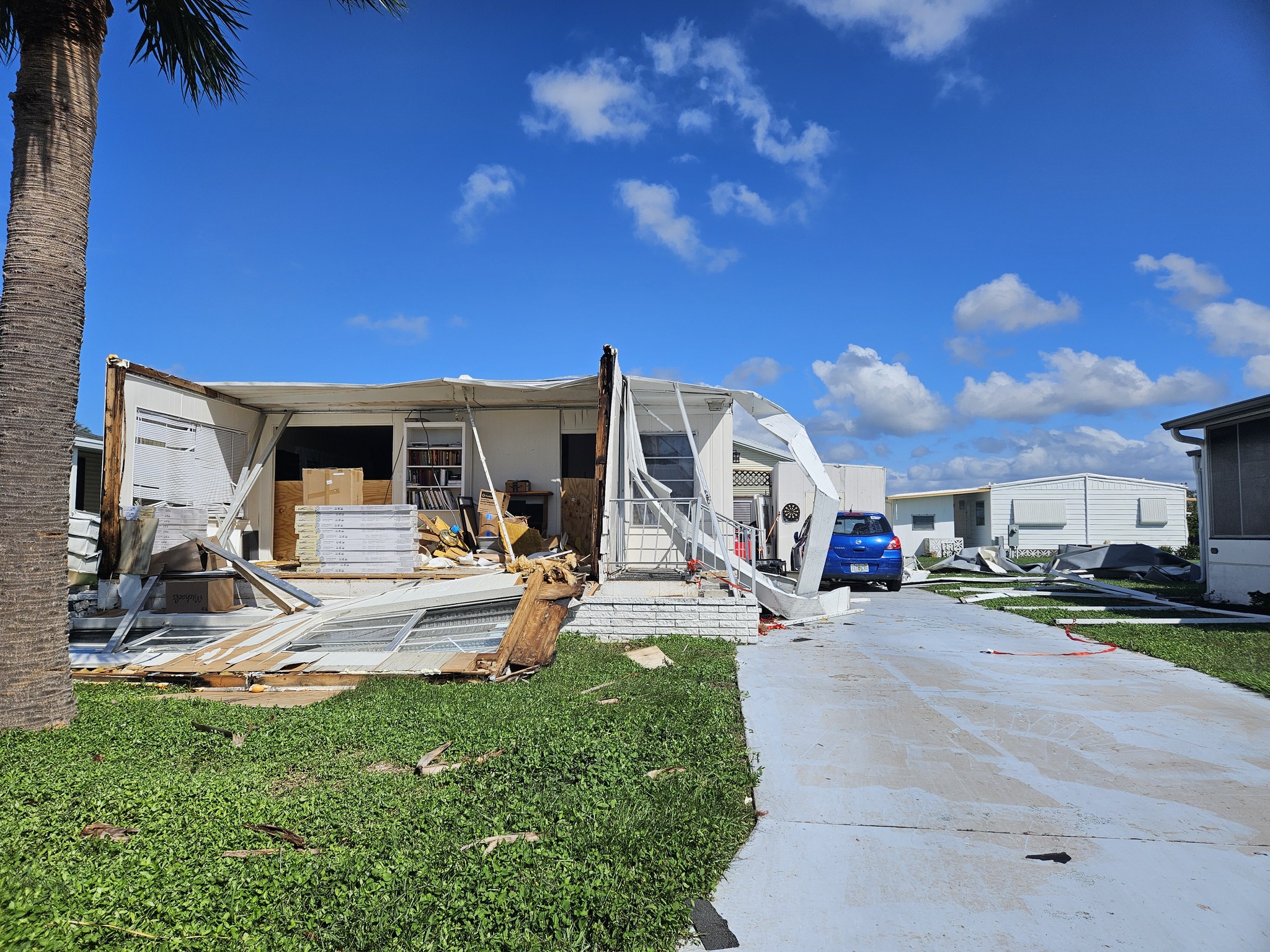
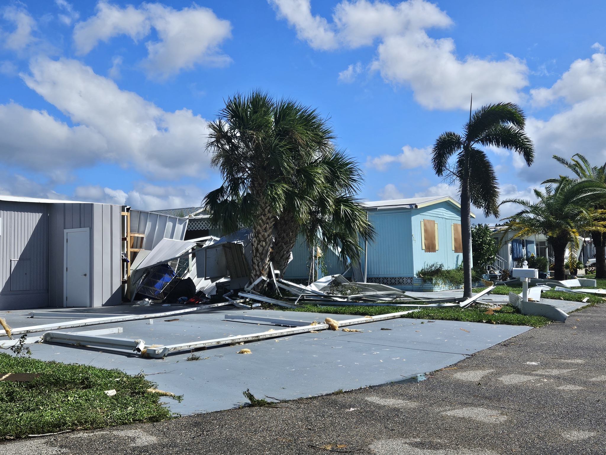
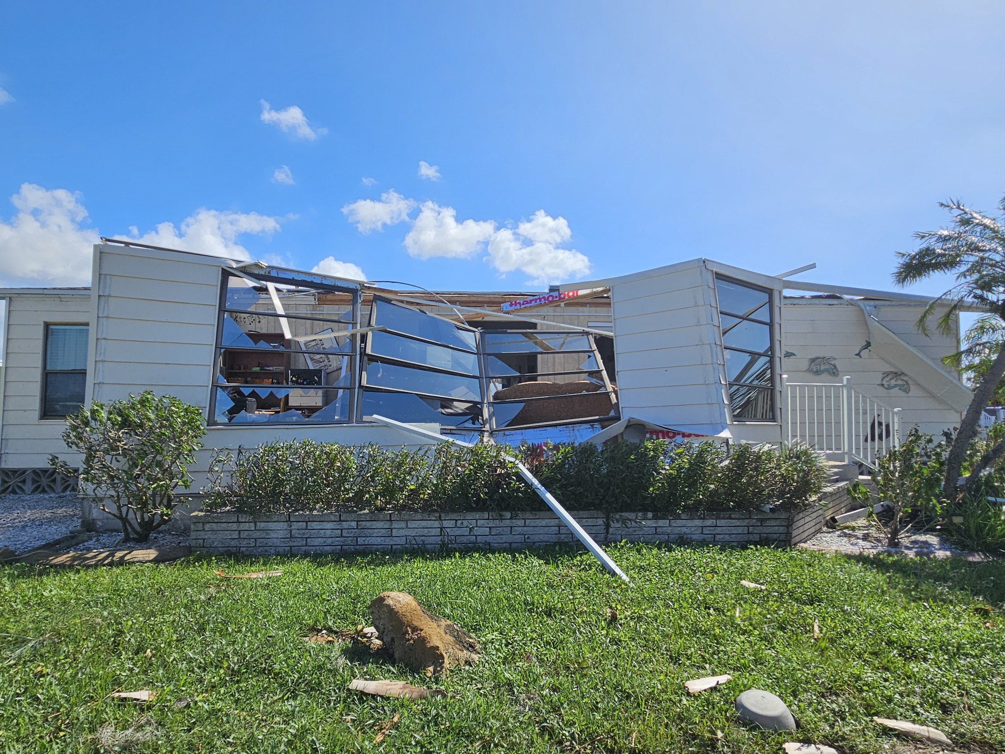
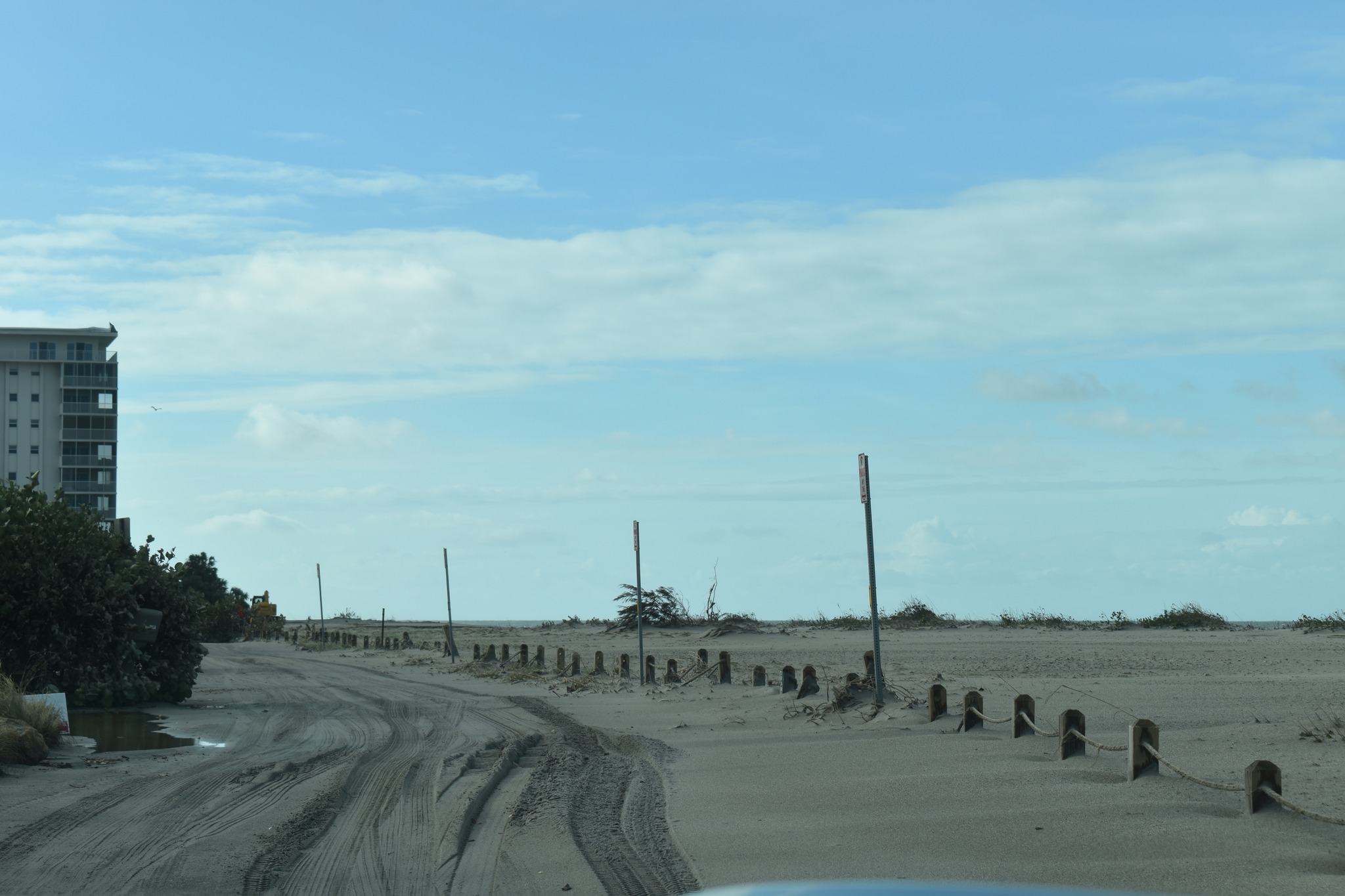
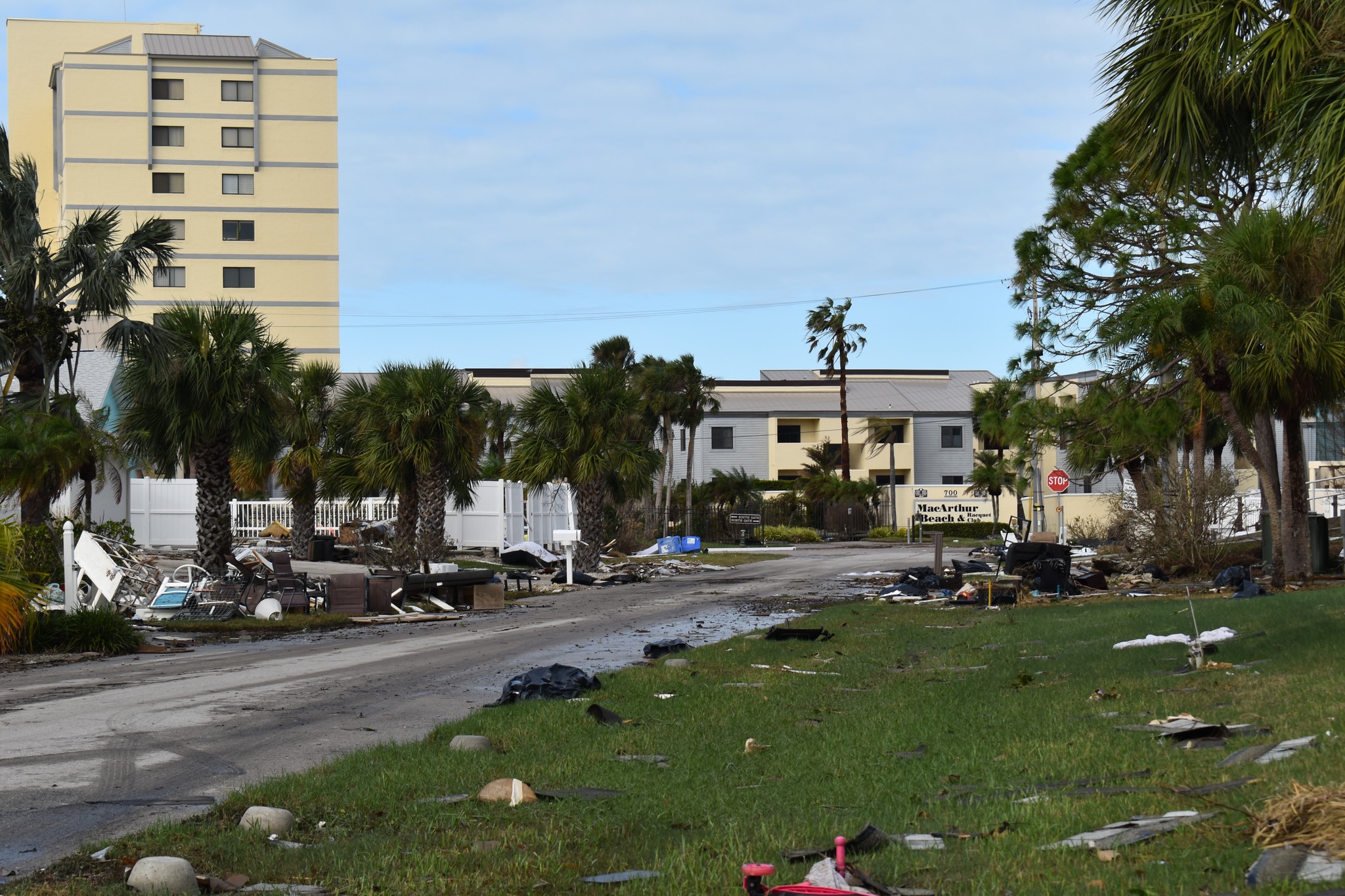
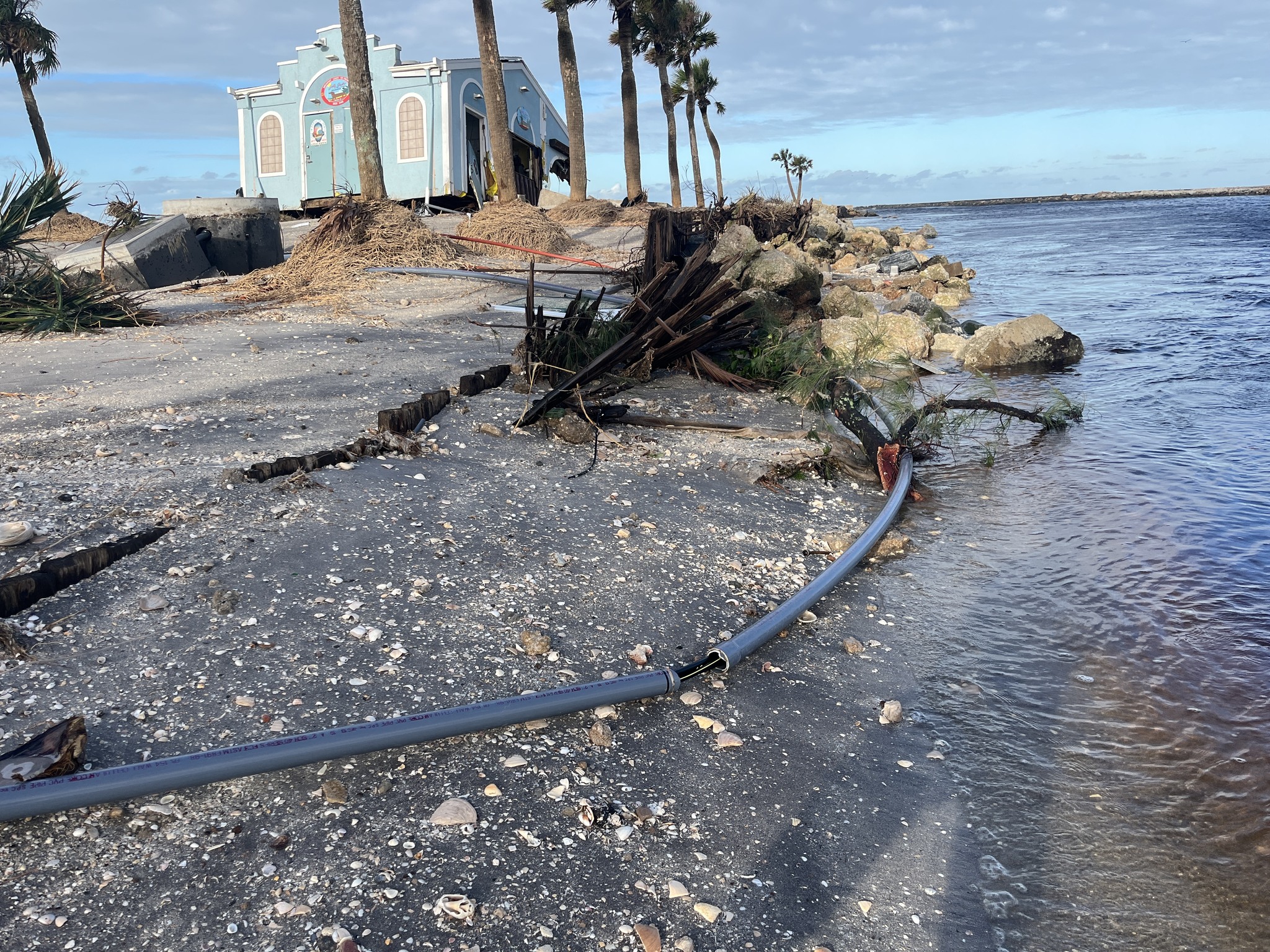
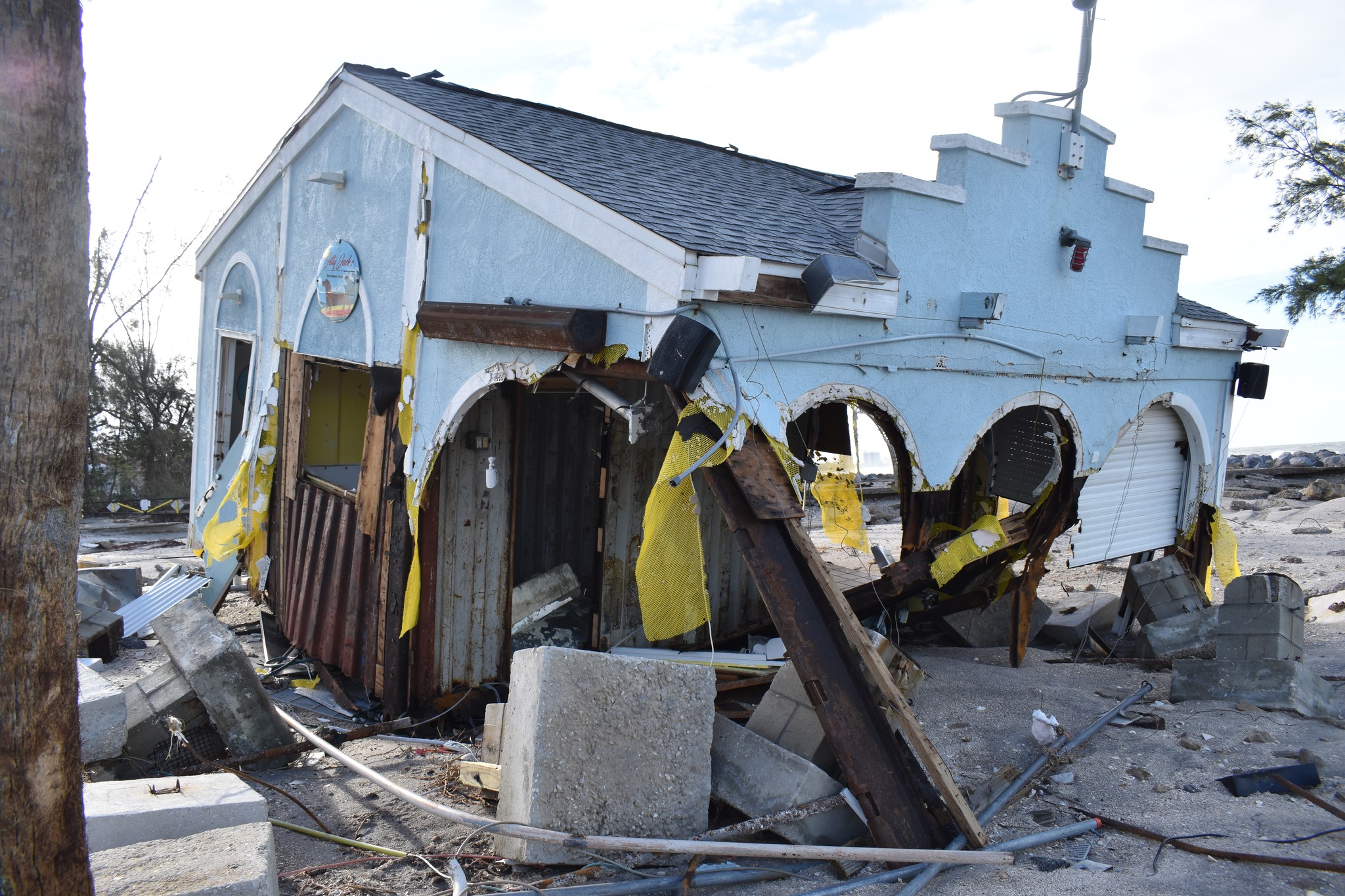
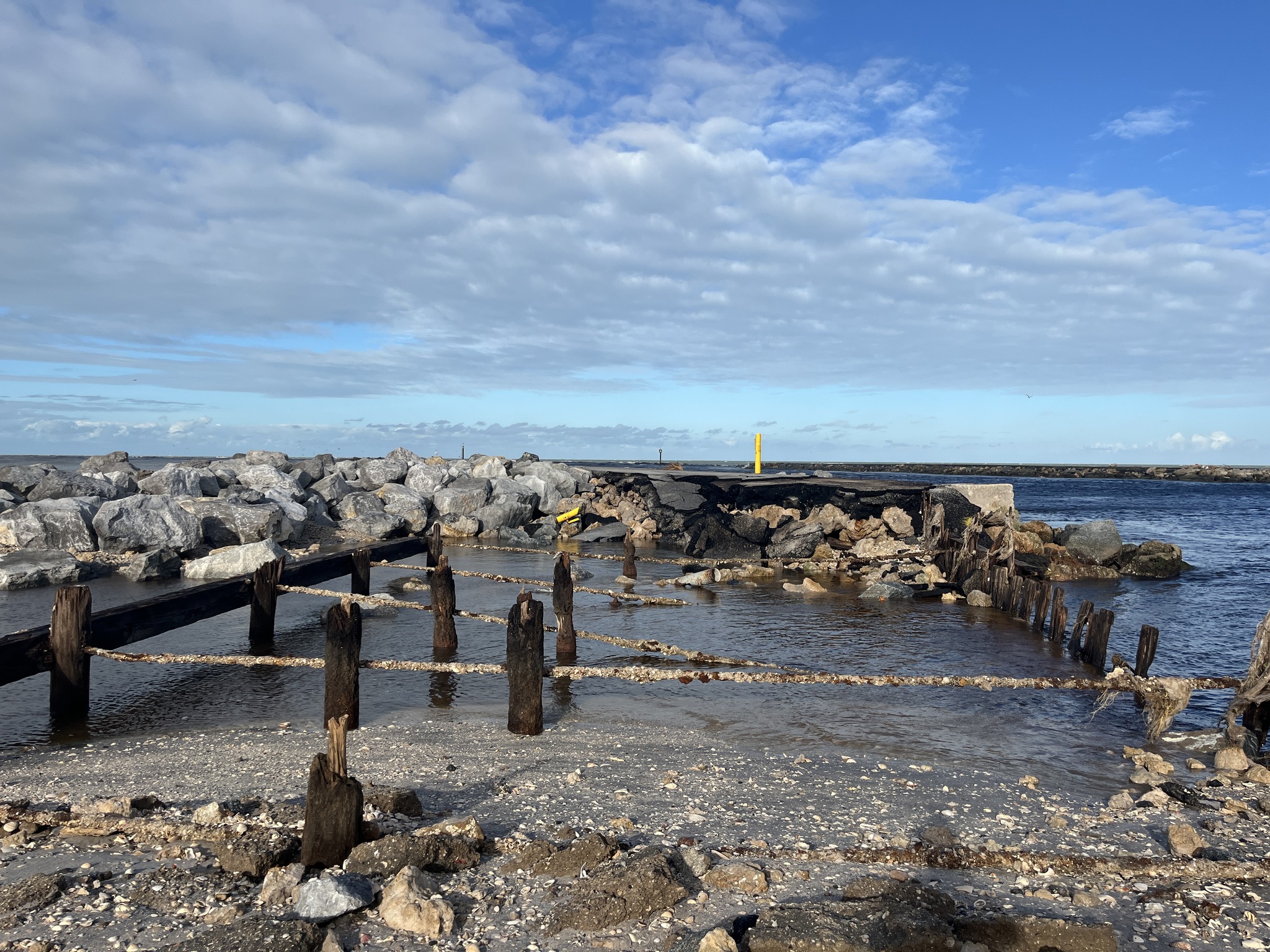
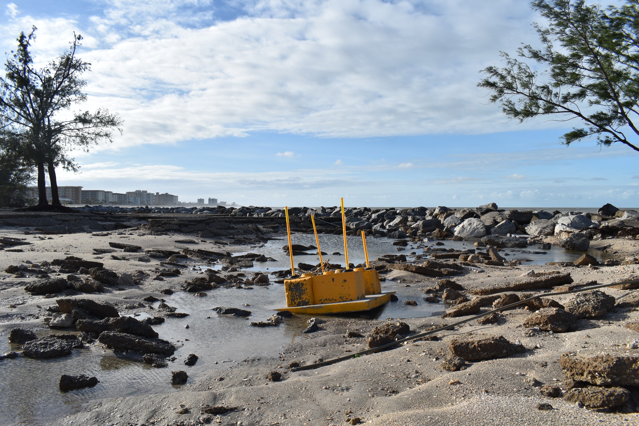
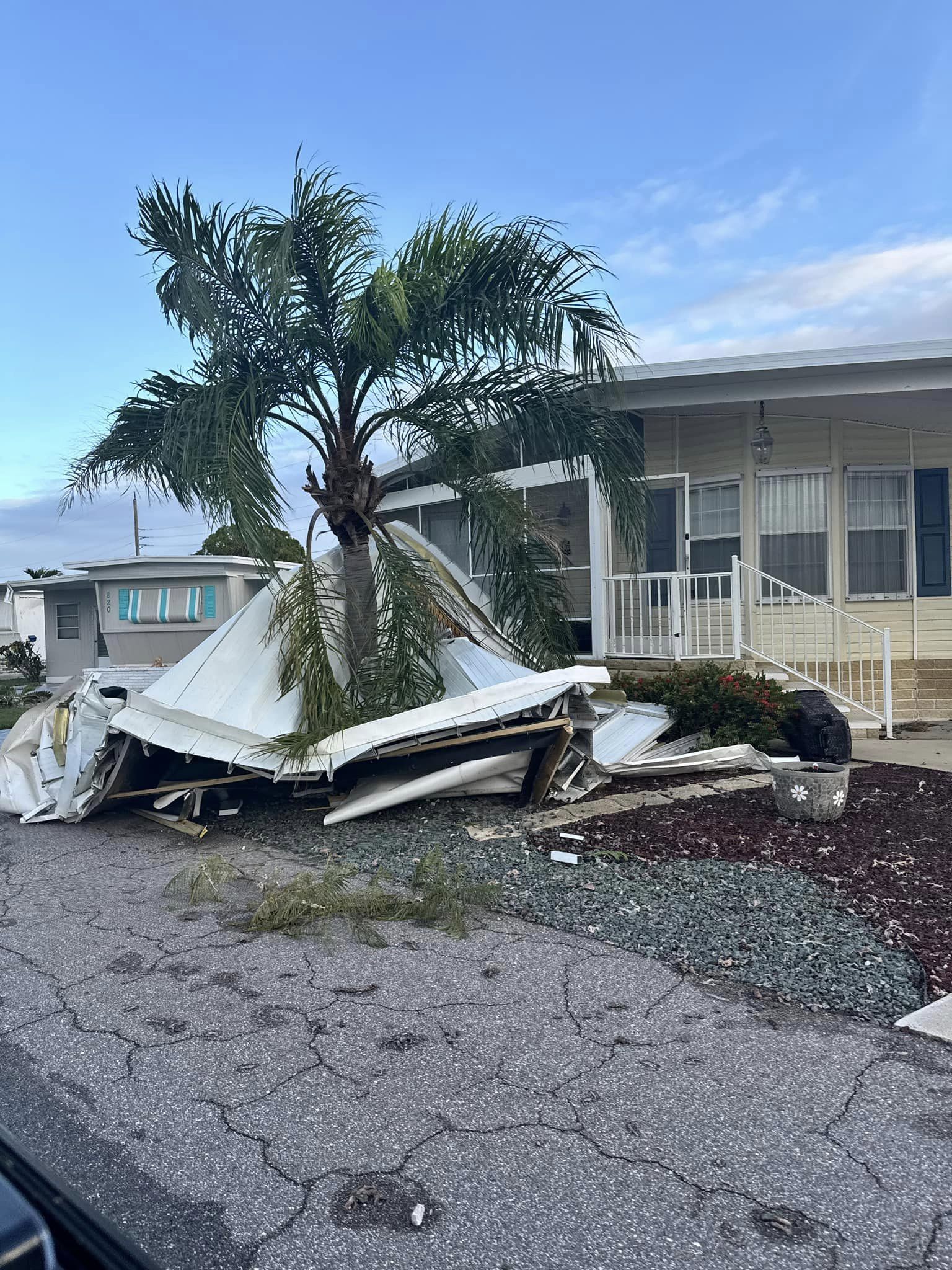
VENICE
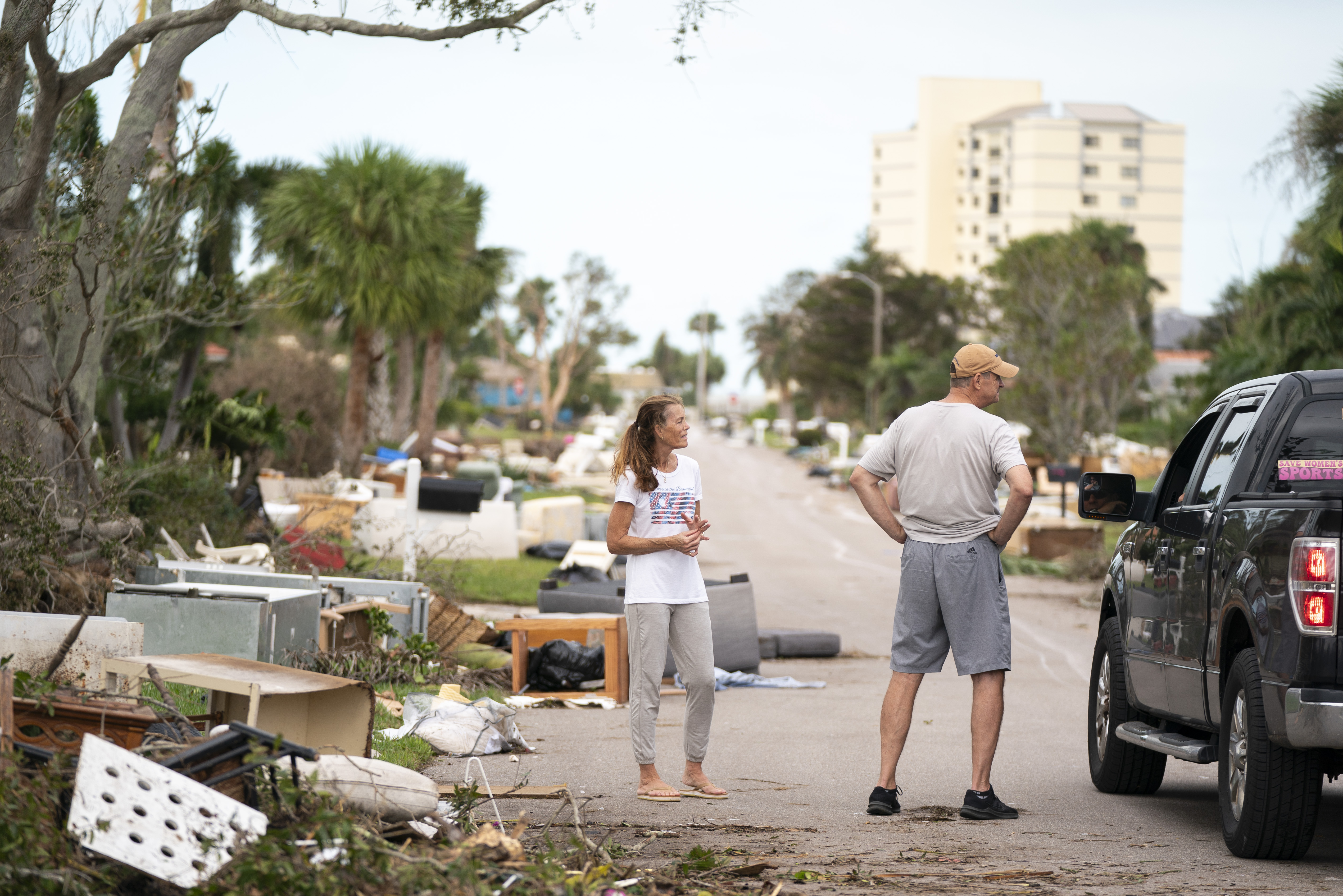
About 15 miles south down the coast from Siesta Key, residents surveyed the damage to their community.
VENICE, FLORIDA – OCTOBER 10: Residents talk to a motorist on a street littered with storm debris from Hurricane Helene and Hurricane Milton in the aftermath of Hurricane Milton on October 10, 2024 in Venice, Florida. Hurricane Milton made landfall as a Category 3 hurricane in the Siesta Key area. (Photo by Sean Rayford/Getty Images) (Photo by Sean Rayford/Getty Images)
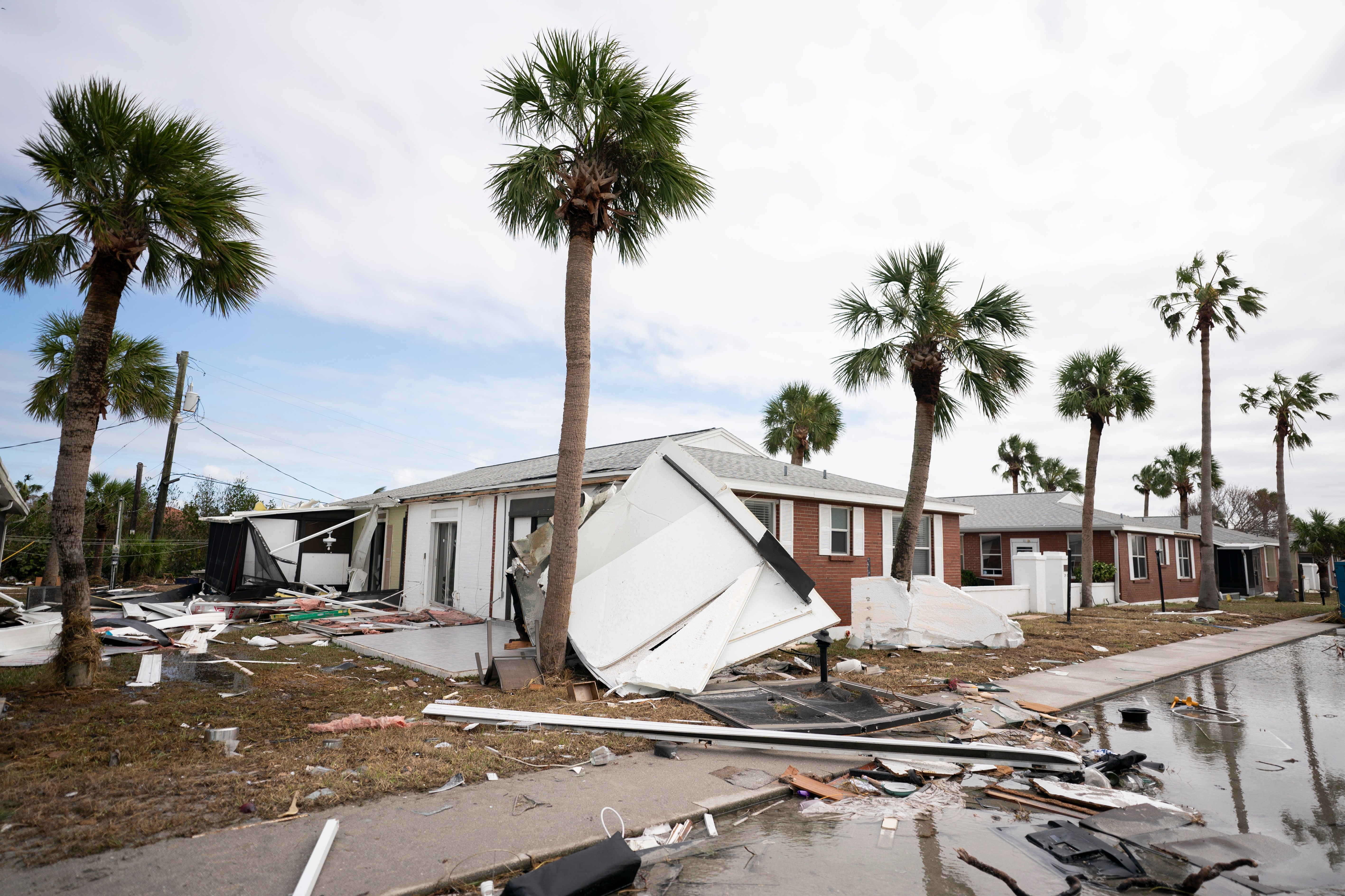
VENICE, FLORIDA – OCTOBER 10: Storm damage in the aftermath of Hurricane Milton on October 10, 2024 in Venice, Florida. Hurricane Milton made landfall as a Category 3 hurricane in the Siesta Key area. (Photo by Sean Rayford/Getty Images) (Photo by Sean Rayford/Getty Images)
Credit: Venice, Florida Municipal Government
Credit: Venice, Florida Municipal Government
Credit: Venice, Florida Municipal Government
Credit: Venice, Florida Municipal Government
Credit: Venice, Florida Municipal Government
Credit: Venice, Florida Municipal Government
Credit: Venice, Florida Municipal Government
Credit: Venice, Florida Municipal Government
Credit: Venice, Florida Municipal Government
Credit: Venice, Florida Municipal Government
Credit: Venice, Florida Municipal Government
Credit: Venice, Florida Municipal Government
Credit: Venice, Florida Municipal Government
Credit: Venice, Florida Municipal Government
Credit: Venice, Florida Municipal Government
Credit: Venice, Florida Municipal Government
Credit: Venice, Florida Municipal Government
Credit: Venice, Florida Municipal Government
Credit: Venice, Florida Municipal Government
Credit: Venice, Florida Municipal Government
Credit: Venice, Florida Municipal Government
City of Venice
City of Venice
City of Venice
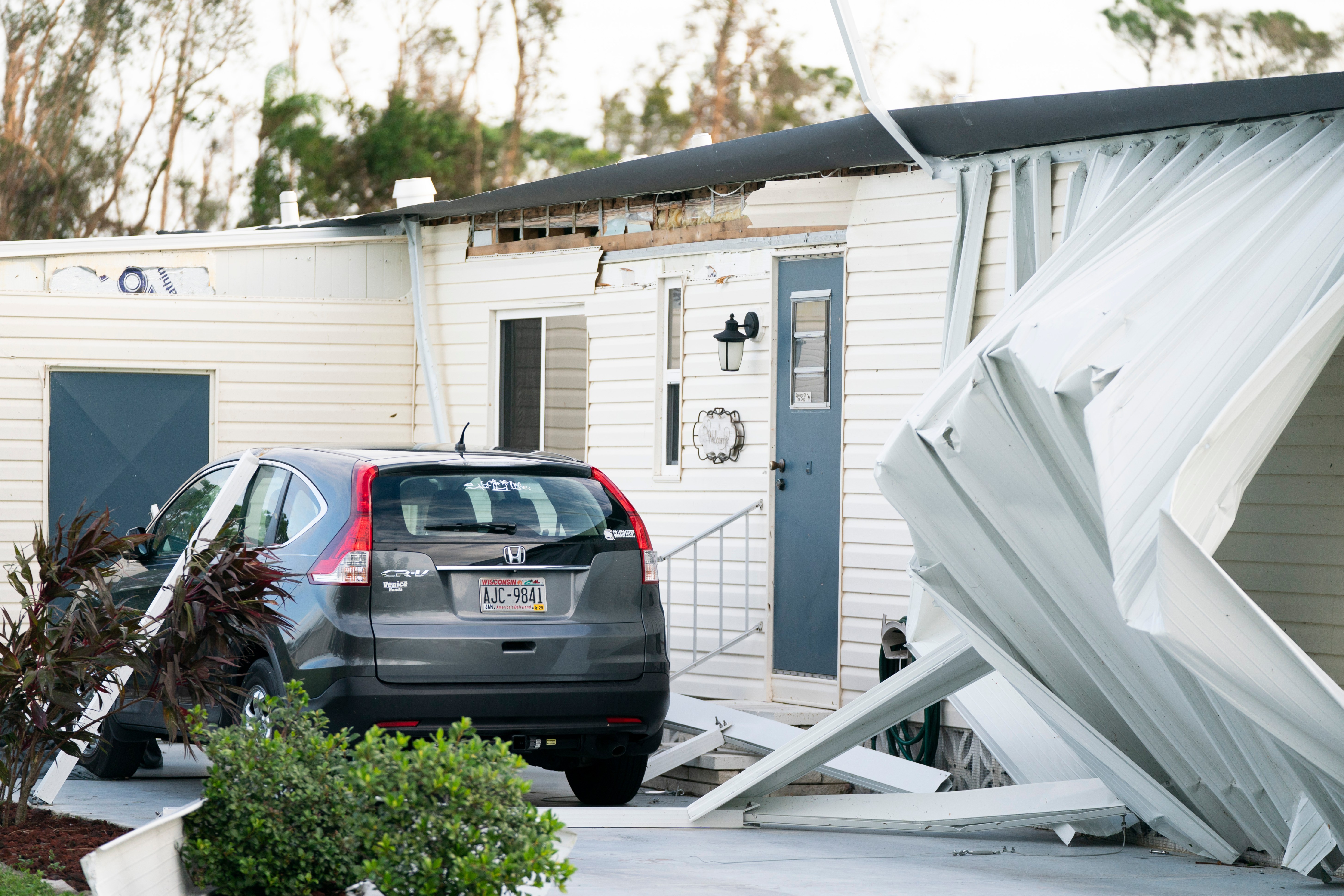
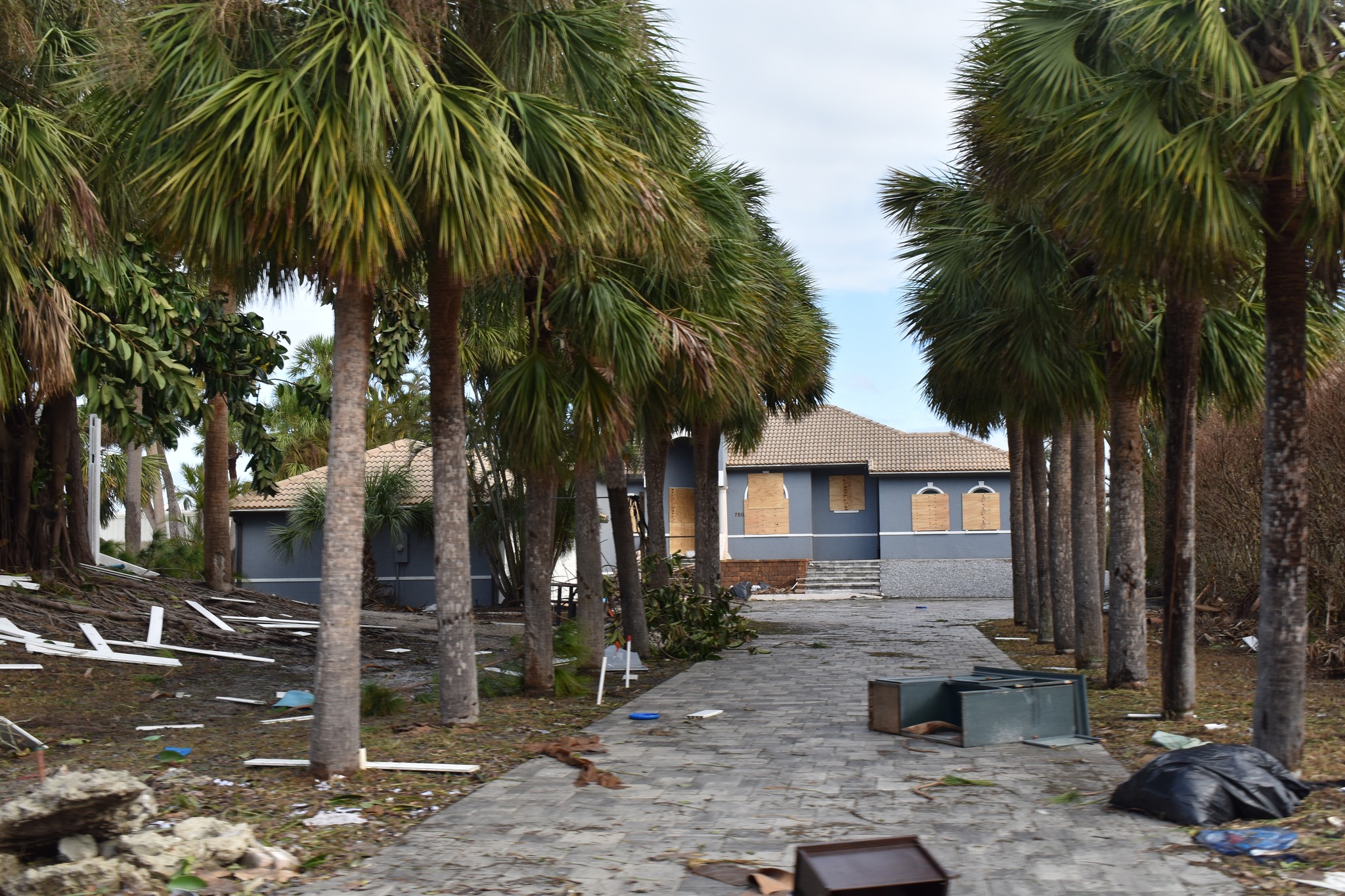
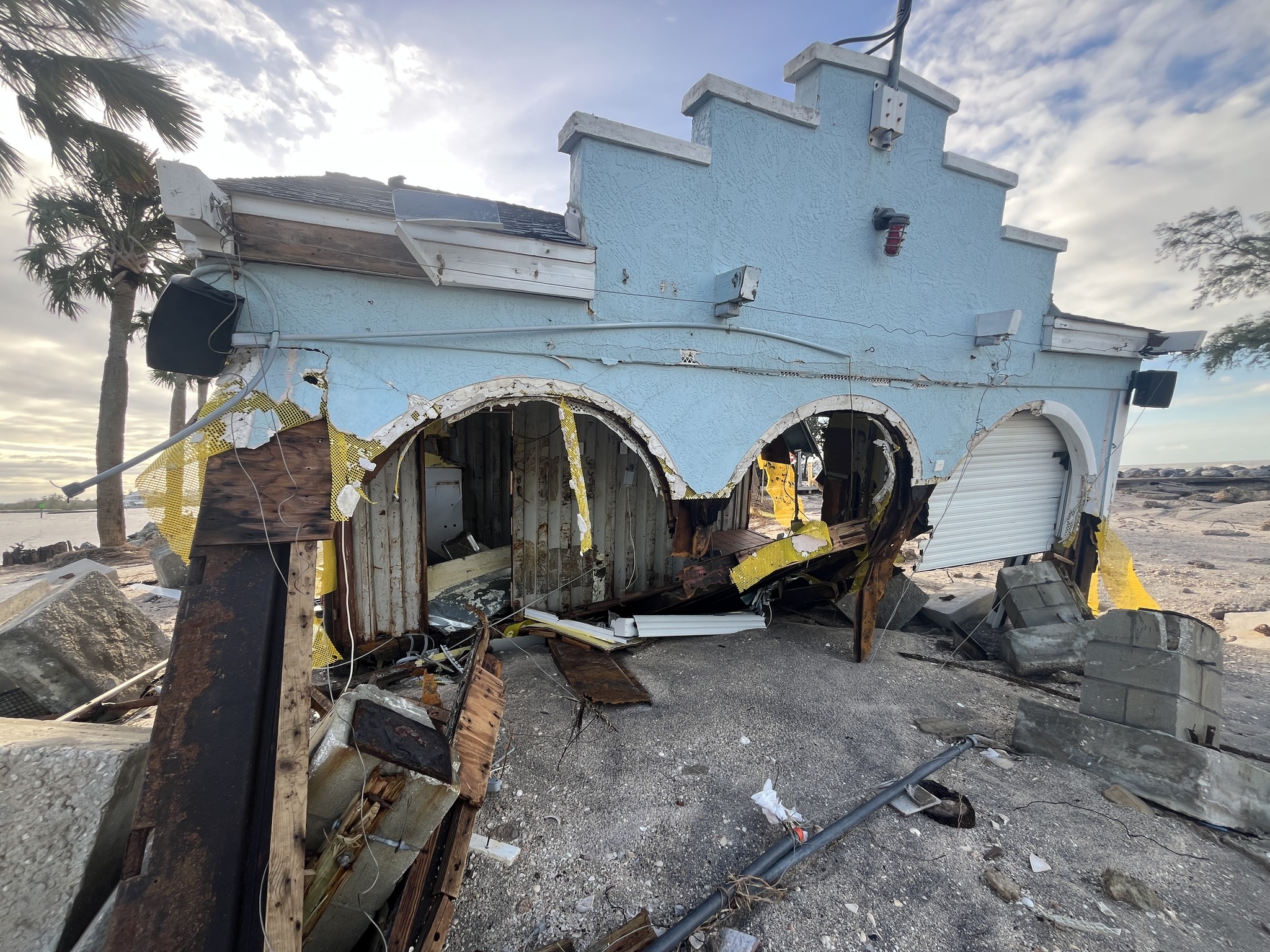
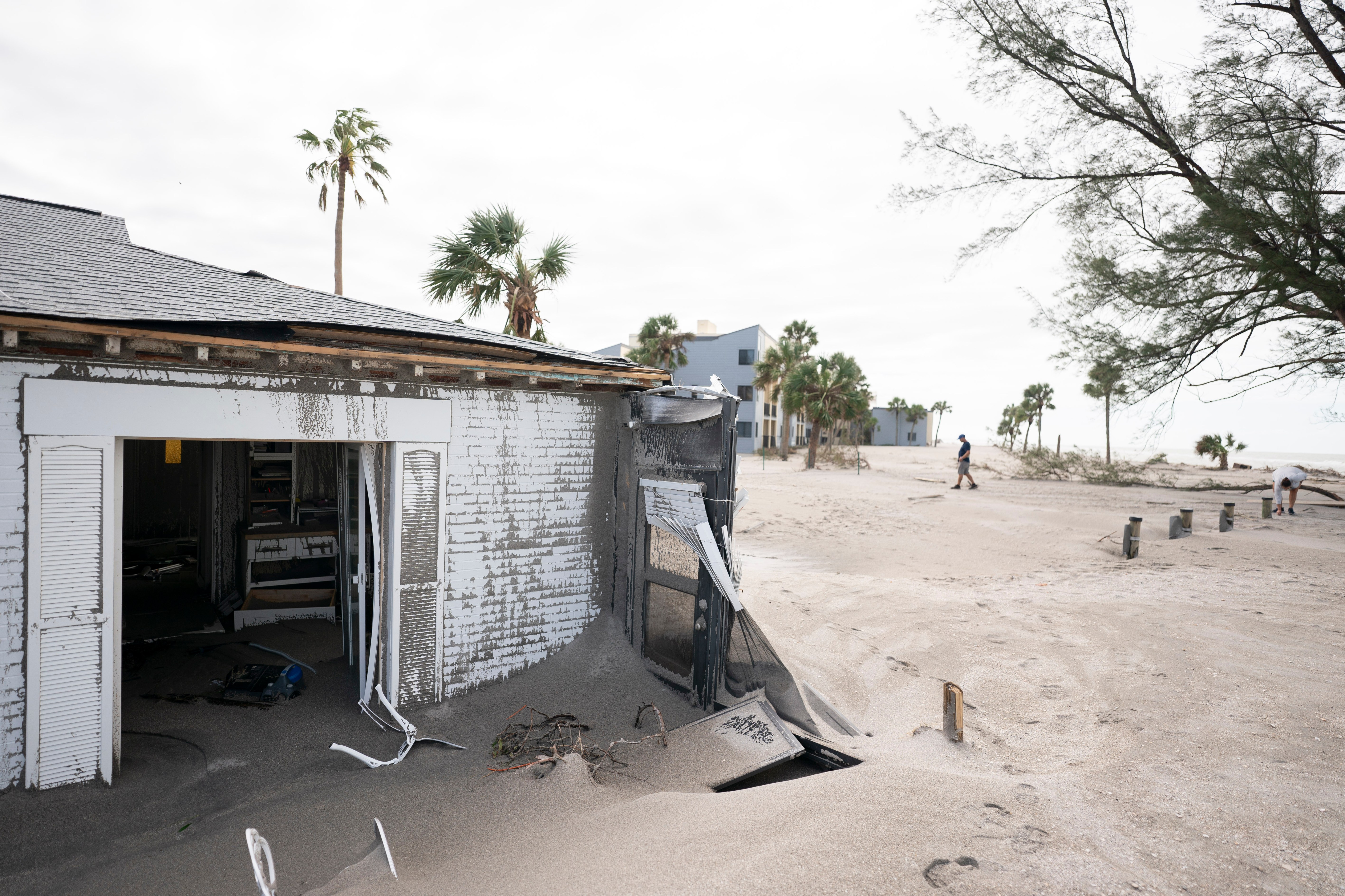
VENICE, FLORIDA – OCTOBER 10: Storm damage at a home in the aftermath of Hurricane Milton on October 10, 2024 in Venice, Florida. Hurricane Milton made landfall as a Category 3 hurricane in the Siesta Key area. (Photo by Sean Rayford/Getty Images) (Photo by Sean Rayford/Getty Images)
VENICE, FLORIDA – OCTOBER 10: Storm damage to beachside property in the aftermath of Hurricane Milton on October 10, 2024 in Venice, Florida. Hurricane Milton made landfall as a Category 3 hurricane in the Siesta Key area. (Photo by Sean Rayford/Getty Images) (Photo by Sean Rayford/Getty Images)
VENICE, FLORIDA – OCTOBER 10: A man uses a smart phone near storm damaged beachside property in the aftermath of Hurricane Milton on October 10, 2024 in Venice, Florida. Hurricane Milton made landfall as a Category 3 hurricane in the Siesta Key area. (Photo by Sean Rayford/Getty Images) (Photo by Sean Rayford/Getty Images)
VENICE, FLORIDA – OCTOBER 10: A man cleans sand off a beach side condominium unit in the aftermath of Hurricane Milton on October 10, 2024 in Venice, Florida. Hurricane Milton made landfall as a Category 3 hurricane in the Siesta Key area. (Photo by Sean Rayford/Getty Images) (Photo by Sean Rayford/Getty Images)
3 / 30
Nearby areas including St. Petersburg saw 18 inches of rainfall and wind gusts of over 100 mph, according to officials. They also confirmed two fatalities during the storm.